Tuesday, 14 August 2018

Swildon's Hole, Priddy

Swildon's Hole is the longest cave on the Mendips, both in terms of total passage length (c.9,144 metres) and the distance from the entrance to the farthest point reached (Sump 12 at c.2,400 metres).  Its alternative name is St Swithin's Hole and the word Swildon may be a corruption of Swithun, who was Bishop of Winchester from 853 until his death in 862 or 865.  Land in the Priddy area was once owned by the Priory of Winchester.  Swildon's Hole extends under the central part of the village of Priddy.

Swildon's Hole was first explored in August 1901 by members of the Wells Natural History and Archaeological Society.  Exploration of the cave system continued and by 1936 about 20% of the extent which is known today, had been discovered.  Since then 11 sumps have been passed, allowing access to much more of the system.  Sump 12 has so far proved to be impassable.

Swildon's Hole is connected to the Priddy Green Sink (also known as Cowdung Swallet - sounds lovely!), which as its name suggests is located close to Priddy Green.  This was first dug in 1959 and 1964 by a consortium of Mendip Caving Clubs.  It was re-opened in 1993 by Bristol Exploration Club and in 1996 it was linked to Swildon's Hole at Cowsh Avens. 

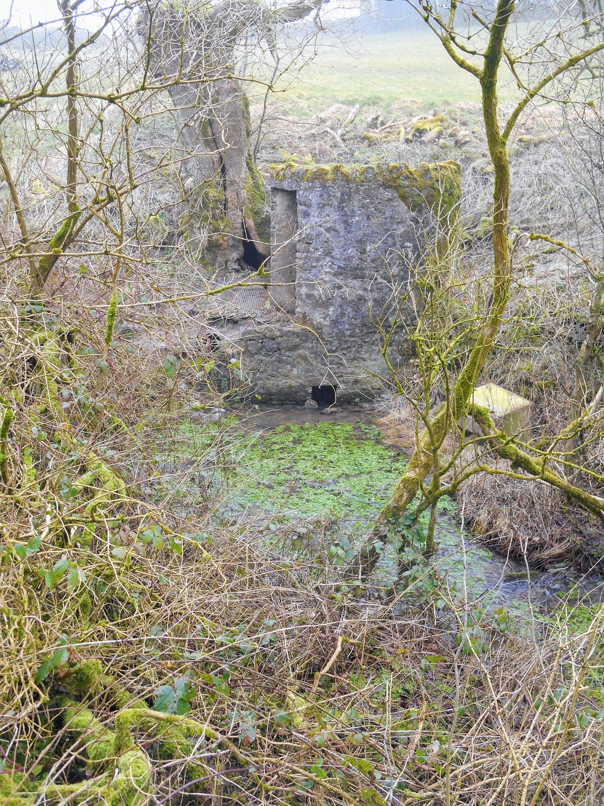
The entrance to Swildon's Hole is a small triangular shaped opening in the floor of a stone blockhouse.  When we visited in February 2018 there was no door on the blockhouse and the hatch was open, presumably because there were people down in the cave.  The water from the stream, which disappears into the ground at Swildon's Hole, reappears at Wookey Hole.

Blockhouse above entrance to Swildon's Hole
 
Entrance to Swildon's Hole
 
Two cavers prepare to enter Swildon's Hole
 
Mendip Cave Rescue Notice on Swildon's Hole Blockhouse
 
Stream entering Swildon's Hole underneath the blockhouse
Blockhouse in the summer - June 2018
 
Entrance hatch to Priddy Green Sink - obviously not used very often
 
Map of Swildon's Hole on display at Priddy Green
 
Notice about the changing barn at Manor Barn, Priddy Green

Wednesday, 1 August 2018

Turnpikes and Toll Houses

By the mid 16th century it was recognised that most roads in England were in a very poor state of repair and that many of them were impassable in winter.  An Act of Parliament was passed in 1555, which attempted to address the problem by placing responsibility for road repair in the hands of parishes.  Each parish was required to elect two surveyors.  Their job was to oversee the repair of roads in their parish.  The labour was provided by the residents of the parish, who were required to spend four days a year each repairing the roads.  In 1562 another act was passed, which increased the number of days per resident to six per year, with fines for those did not comply.  However much of the damage to roads was caused by traffic passing through, rather than by local residents.

Local Justices of the Peace were given the powers by Parliament to erect toll gates on part of the Great North Road (now the A1) in 1663.  Twelve more Justice Trusts were set up between 1696 and 1714 on sections of road, which were particularly badly maintained.  Local groups of wealthy people paid for improved roads to be built and then charged people tolls for using them.  

The first turnpike trusts were set up in 1707 and were run by trustees, who were local Justices, gentlemen and landowners.  The trusts were non-profit making, but their funds were not subject to audit and there was no legal requirement to keep any roads in a good state of repair.  They were given powers to set and levy tolls on the users of specified stretches of road, usually about 20 miles in length.

133 turnpike trusts were set up by Acts of Parliament before 1750.  Between 1751 and 1772 another 418 acts were passed and the turnpike network expanded across the whole of England, although only about a fifth of Britain's roads were turnpikes.  The last act was passed in 1836, by which time the railway network was beginning to be developed.  Turnpikes were used by stage coaches from the 1750s, where the road conditions were good enough.

The 1st turnpike trust in Somerset was the Bath Trust in 1707, then Bristol in 1727 and Bridgwater in 1730.  Most of Somerset's turnpike trusts were set up between 1752 and 1759. The network of turnpike roads in Somerset was initially the existing main and secondary roads, which were widened and improved.  A few new roads were built later.

Turnpikes trusts erected gates across their roads at strategic locations to collect tolls from the people who used them.  Early turnpikes had wooden gates but those built in the 19th century often had gates made of wrought iron.  The gates were often at points where it was least likely that horse riders or horse drawn vehicles could avoid paying the toll e.g. bridges and crossroads.  They were usually located outside urban areas to avoid charging local businesses. 

The word turnpike was originally a military term for "a spiked barrier fixed in or across a road or passage, as a defence against sudden attack, especially of men on horseback." (Oxford English Dictionary).  The bars erected on toll roads resembled these barriers and so they were referred to as turnpikes from the late 17th century.

In some cases existing cottages were adapted to house toll collectors (or pikemen as they were sometimes known) and their families.  Sometimes temporary shelters were built for the toll collectors.  Later on most toll houses were purpose built.  Early toll houses were built in the same style as local cottages in the area but by the 19th century a distinctive style evolved.   Many toll houses resembled the lodges built at the entrance to large estates and those built in the 1820s had polygonal fronts, which gave the toll collectors good views up and down the roads.  Toll houses were usually built close to the road and many of them had porches, which jutted out into the road.   On major roads grander toll houses were built e.g. with castellations on them to impress wealthy travellers.  The isolated location of most toll houses meant that they were vulnerable to attack by thieves and highwaymen.  Therefore the windows often had shutters and/or bars on them and the houses also had built-in safes.  Toll houses were often built to a higher standard that most of the local vernacular cottages, in order to attract honest and reliable toll collectors.

In the early 19th century there were two different methods of road construction in general use, which had been developed by Thomas Telford (1757-1834) and John Loudon McAdam (1756-1836).  Telford's method with 9" long stones packed together on end, with smaller stones rammed into the top and a layer of small stones on the top, was very effective, but also expensive.

McAdam's method was cheaper: stone was broken into pieces weighing less than 6 ounces.  This was then spread in layers to a depth of 10". This method re-used material recovered from earlier surfaces.  The surface was not rolled - it was gradually compacted by passing traffic. 

John Loudon McAdam became the General Surveyor to the Bristol Turnpike Trust in December 1815.  He worked for the Bristol Trust with his son, who was also called John Loudon McAdam, until his death in 1836.  In 1826 he also became General Surveyor for the Bath Trust.  He worked for the Bath Trust with his grandson William until 1836.

The turnpike road network reached its greatest extent in the 1830s when there were over 20,000 miles of roads controlled by over 1,000 trusts in England and Wales.  Traffic on the turnpike roads declined from the 1840s as the railway network developed.  

Most turnpike trusts were wound up in the 1870s and the toll houses were sold off.  Some became commercial buildings such as pubs and post offices but most became residential dwellings.  The last turnpike trust to be wound up was one on Anglesey in 1895.  

Responsibility for roads was taken over by Highway Districts from 1862.  Highway Districts were abolished in 1894 and their duties and powers passed to Rural District Councils.  Responsibility for main roads passed to the newly formed County Councils in 1889.

Roads continued to be built and maintained using the Telford and McAdam methods until the early 20th century.  Main roads in Somerset were surface dressed with tar from 1908, but it wasn't until the 1920s that they were constructed using several inches of stone, which had been pre-coated in tar or bitumen.

Toll House, Nether Stowey

Toll House, Snowdon Hill, A30, Chard

Horsington Toll House

Horsington Toll Board

Stanton Drew Toll House

Worthy Toll Road Toll House, Porlock Weir - still in use as a toll house

Toll House, Glaston Road, Street
You can see where the original doorway facing the road has been blocked up at some point.

Toll House, Glaston Road, Street

Toll House at Shipham

Red Post Toll House on the A367 at Peasedown St John

This house on Silver Street in Taunton was probably once a toll house

Exebridge Toll House on A396 at the Devon/Somerset border

Toll Cottage, Tower Hill, A358, Williton


Sidcot Gate Toll House on the A38 at Sidcot

Blue plaque on the Sidcot Gate Toll House

Old Down Toll House
This was built in 1835 and is located on the B3139 (Lynch Hill), opposite the junction with Coalpit Lane.


Hartlake Turnpike plaque at the junction of the A39 with Chasey's Drove, to the north of Glastonbury.  This was part of the Wells Turnpike Trust.

Terminus stone on the Brendon Hills at Elworthy, marking the western boundary of the Taunton Turnpike Trust
The Taunton Turnpike Trust was in operation from 1752 until 1875.

Part of the toll board from Misterton Gate
This is now on display in the Museum of Somerset in Taunton.

East Cranmore Toll House on the A361

Charlton Toll House on the A361 at Shepton Mallet

Toll Cottage, on the corner of Ford Road (B3188) and Taunton Road (B3227) in Wiveliscombe

Toll house, 48 Chilkwell Street, Glastonbury

Modern toll board on the toll house, 48 Chilkwell Street, Glastonbury

Toll house at Horton Cross near Ilminster

Toll house on Station Road, Ilminster

Turnpike House, Westhay
This toll house was on the Wedmore Turnpike Trust's road across the Somerset levels to Rowberrow.  It is on the corner of Main Road  (B3151) and Westhay Moor Drove. The blank wall facing the road is where the original doorway would have been located.

Toll house, Kingbury Epsicopi
This toll house, which is located on Thorney Road, was built in the early 19th century for the Langport, Somerton and Castle Cary Turnpike Trust.

Turnpike Cottage, Crimchard

Further Reading:

The Toll-houses of Somerset by Jane Dowding and Patrick Taylor.  Published by Polystar Press, 2013

Somerset Roads: The Legacy of the Turnpikes, Phase 1 Western Somerset by J.B. Bentley and B.J. Murless.  Published by Somerset Industrial Archaeological Society, 1985

Sunday, 15 July 2018

Angels and an Arc of Angels

Angels are God’s messengers and they are most often found in places of worship.  However in parts of Somerset they can also be found in some more unexpected places.

Angel Roofs

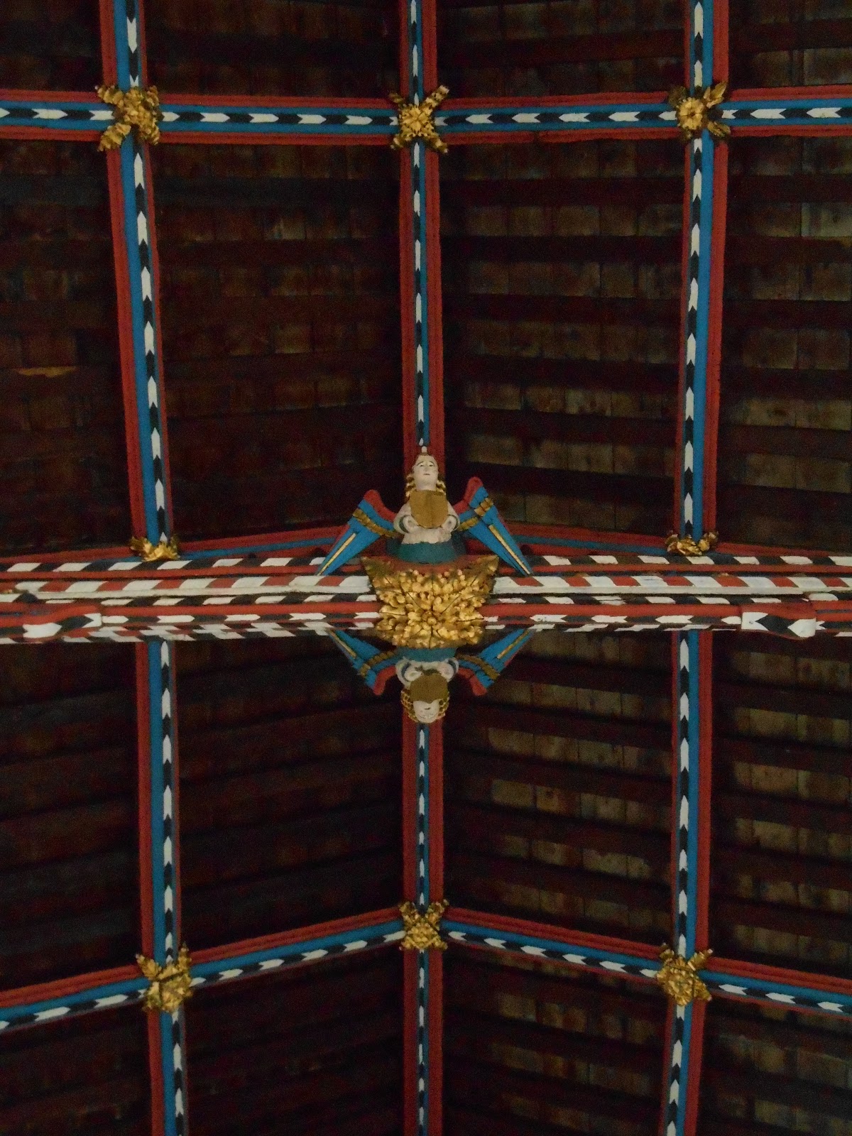
In the 15th and early 16th centuries several hundred angel roofs were built in England.  Of these, more than 140 angel roofs survive. They are almost always found in churches, and over 80% are located in East Anglia, particularly in Norfolk and Suffolk.  Bedfordshire, Devon and Denbighshire have a handful between them and Somerset has more than a dozen, depending on how many angels you need for it to count as an angel roof:
  • St Cuthbert's Church, Wells 
  • Selworthy
  • Evercreech
  • Taunton Minster
  • Long Sutton
  • Westonzoyland
  • Muchelney
  • Leigh-on-Mendip
  • Cleeve Abbey
  • Martock
  • Norton St Philip
  • Doulting
  • St Decuman's Church, Watchet
The earliest known angel roof is at Westminster Hall in London.  It was constructed between 1395 and 1398.  Many angel roofs were destroyed by Protestant iconoclasts during and after the 1540s.  However some survived, probably because being so high up they were out of easy reach.  Some surviving angel roofs are colourfully painted, while others are plain wood.

Angel at Cleeve Abbey

Cleeve Abbey Refectory Roof
This wagon roof was constructed in the 15th century by Abbot David Juyner.

 
Cleeve Abbey Gatehouse

All Saints' Church, Selworthy

Entrance doors, St Mary Magdalene Church, Taunton

St Mary Magdalene Church, Taunton

St Mary Magdalene Church, Taunton

St Mary Magdalene Church, Taunton

St Giles' Church, Leigh-on-Mendip

St Giles' Church, Leigh-on-Mendip


Leigh-on-Mendip

Church of St Peter and St Paul, Muchelney
This is an unusual roof of painted angels, which were painted in the early 17th century

Mulchelney

Angels behind the altar at Holy Trinity Church, Chantry

St Peter's Church, Evercreech

St Peter's Church, Evercreech

St Peter's Church, Evercreech

St Cuthbert's Church, Wells

St Cuthbert's Church, Wells

St Cuthbert's Church, Wells

St Cuthbert's Church, Wells

St Audries' Church, West Quantoxhead

All Saints' Church, Martock
The angel roof in All Saints' Church was completed in 1513.  Sadly I wasn't able to get a good photograph of it, as the church was dark and the roof is very high.

19th century hammer beam trussed roof in the nave of the church of St Peter and St James at Norton St Philip with carved angels

Angel at Norton St Philip

Close to Bristol Airport and at the entrance to a track leading to Felton Common and St Katharine’s Church, there is an angel looking skywards, as if he is about to take flight.  He was carved from a dead beech tree by Gloucestershire based artist Ant Beetlestone in 2010.  July 2025 update: the angel is no longer there.

Felton's Angel

 
Angel looking skywards

Back of the Felton Angel

Arc of Angels, Portishead Marina
The Arc of Angels, which is located in Central Park, was designed by Rick Kirby and erected in 2002.  It represents the new community at Portishead Marina, which gains strength and support from being united. The piece also commemorates the Second World War radio masts, which once stood near the site.
Portishead’s Arc of Angels

Arc of Angels

Angel in a wall painting at St Mary's Church, Stoke-sub-Hamdon

Angels painted on the east wall of the chancel of St Laurence Church, East Harptree 

Etched angels on the door handle of the Minster in Ilminster

Four stained glass angels around St Catherine in the Minster at Ilminster
This window is a memorial to Charles & Elizabeth Bailey and their daughter Mabel Bailey.  
It was dedicated in 1964. 

Chainsaw carving of an angel in the woods on the National Trust's Tyntesfield estate

Angels on a kneeler in St Mary Magdalene's Church, Exford

St Decuman's Church, Watchet

Knife Angel, Taunton

Knife Angel, Taunton

Angel Roof, Holy Trinity Church, Long Sutton

Musical Angel, Holy Trinity Church, Long Sutton
This was made by Thea and Gordon Miles 2013-14 and given to Holy Trinity Church in July 2015.  They were inspired by one of the maquettes made by the sculptor Paul Fletcher for a commission from Bath Abbey.  12 different musical angels were then carved in lime wood by Paul Beckford and installed at the top of the quire screen in Bath Abbey.

All Saints' Church, Chipstable

St Decuman's Church, Watchet

St Cuthbert's Church, Wells

Marble angel supporting the altar rail at St Gregory's Church, Weare

St Andrew's Church, Chew Stoke

St Andrew's Church, Chew Stoke
When the church was restored in the 1860s, the interior was decorated with 156 angels in wood and stone.

Font, All Saints' Church, Wrington