Saturday, 18 September 2021

Poets' Walk, Clevedon

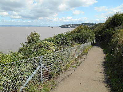
The town of Clevedon has connections to two of England’s best known poets. Poets’ Walk is a popular footpath which runs along the coast and around Wain’s Hill and Church Hill at the southern end of Clevedon.  The walk is said to have inspired poets such as Alfred Tennyson, Samuel Taylor Coleridge and William Makepeace Thackeray, who visited the town.  The formal path which exists today was constructed in 1929. Poets’ Walk was designated as a Local Nature Reserve in 1993.

Poets' Walk signpost


Poets' Walk

Poets' Walk

Poets' Walk

The Sugar Lookout is a feature on Poets’ Walk. It was built by Ferdinand Beeston in around 1835.  It is said to have been used in the mid-19th century by a family of sugar importers called Finzel to look out for ships sailing up the Bristol Channel, which were carrying sugar from the West Indies.  It later fell into ruin but has recently been restored.

Sugar Lookout overlooking the Bristol Channel

Samuel Taylor Coleridge and his wife Sarah spent the first few months of their married life in a cottage on Old Church Road in Clevedon in 1795.

Coleridge Cottage, Old Church Road, Clevedon

In the mid-18th century the author William Makepeace Thackeray was a frequent visitor of the Elton Family, who lived at Clevedon Court.  He is best known as a novelist but he did also write some poetry.

Alfred Tennyson had a close friend at Cambridge University called Arthur Hallam.  Arthur’s mother was a member of the Elton family of Clevedon Court.  Arthur, who was a poet and essayist, was engaged to marry Tennyson’s sister Emily but he died suddenly in Vienna in 1833 at the age of 22.  His body was brought back to England and he was buried in the family vault at St Andrew’s Church in Clevedon.  In 1850 Tennyson wrote a poem called In Memorium in tribute to his friend.  In the same year he made his first visit to Clevedon.  The house on Old Church Road in Clevedon, where he is said to have stayed, is called Tennyson House.   A nearby road is called Tennyson Avenue.

Tennyson House, Old Church Road

Tennyson Avenue, Clevedon

St Andrew's Church, Clevedon

Wednesday, 1 September 2021

Goblin Combe

Goblin Combe is a gorge, which was formed during the last ice age by melting snow and ice cutting into limestone. It is located to the east of the village of Cleeve. The site is comprised of a steep sided dry valley with extensive areas of limestone scree, areas of semi-natural ancient woodland, unimproved calcareous grassland and limestone heath.  These types of habitat are rare in England and Goblin Combe was designated as a Site of Special Scientific Interest in 1999.  How the valley came to be called Goblin Combe is not entirely certain.  In the past it was also known as Gobble Combe and Eagle’s Combe

Most of Goblin Combe and the limestone grassland to the north of it is a nature reserve, which is owned and managed by Avon Wildlife Trust.  A public footpath runs along the bottom of the combe and there are a number of other permissive paths in the nature reserve and in the adjacent woods at the east end of the combe.

The woodland consists mainly of oak and ash trees with some beech, field maple, yew, whitebeam and hazel. In the dim light at the bottom of the combe ferns such as hart’s tongue and the rarer limestone and moonwort ferns grow. The nationally scarce stinking hellebore grows on the limestone screes. 

Over 30 types of butterfly have been found in the vicinity of Goblin Combe, including some rare varieties: grizzled and dingy skippers; silver washed and dark green fritillaries; purple and green hairstreaks; brown argus, grayling and white admiral.  Dormice and greater horseshoe bats also live in the combe.  Visitors are however unlikely to encounter any goblins! 

The ramparts of an ancient hillfort can be seen at Cleeve Toot to the north west of Goblin Combe.  It is thought to date from the late Bronze or early Iron Age.   150 metres to the north of the hillfort are the remains of another smaller ancient settlement.

Goblin Combe Environment Centre, which was located in a Victorian former school building on Plunder Street at the west end of the combe, provided learning and outdoor experiences for schools, clubs, youth and community groups but closed down in 2018.  The future of the building is currently uncertain.

The peace and quiet of the combe is broken intermittently by planes flying low overhead, as Goblin Come is very close to the western end of Bristol Airport’s runway.

Top of the limestone cliffs on the north side of the gorge

Public footpath along the bottom of Goblin Combe

Permissive path up the side of Goblin Combe

Seat at the bottom of Goblin Combe

Steep side of Goblin Combe

Goblin Combe Environment Centre

Plane coming into land at Bristol Airport seen from the edge of the woods at the east end of Goblin Combe