Friday, 18 December 2015

Christmas Lights, Trinity Close, Burnham-on-Sea

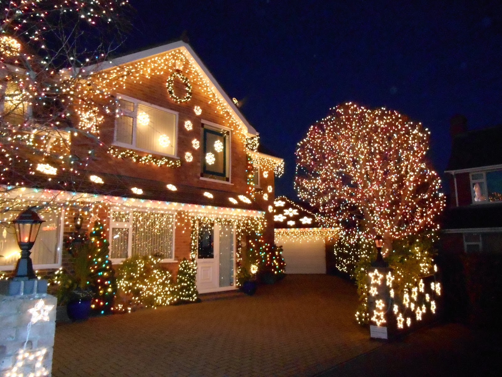
Trinity Close is a small cul-de-sac in Burnham-on-Sea.  Unremarkable for 11 months of the year, for the whole of the month of December it is lit up.  The tradition was started by Nick and Hazel Gardner in 2001. The aim is to raise money for local charities and over the years more than £60,000 has been raised.  The homes in the close are decorated with over 100,000 lights.  When I visited in December 2014 only one of the houses in the close had no lights at all. 

The photos below were taken in December 2014.

Trinity Close

Trinity Close

A winter wonderland

 The most colourful house

Santa and three of his reindeer

 Beautiful tree

Thursday, 3 December 2015

Ashwick Grove House, Oakhill

Ashwick Grove House is a shadow of its former self.  In the late 18th century an existing house was altered and enlarged for the agricultural improver John Billingsley (1747-1811).  His family had lived there since the 1690s.  At the rear of the house there was a row of buildings, which were cut into the rockface and possibly used as cold stores.  The main entrance to the house was along a tree lined avenue from the south.  There was a lodge house on what is now Fosse Road.  The Fosse Way runs roughly parallel to the avenue and no more than a couple of hundred metres to the east of it. The house stood in a landscaped park and had a formal garden adjacent to the east side of the house and a wilderness garden to the east of the formal garden.  The wilderness garden blended into Home Wood.  There was a rustic stone grotto set high on the steep slopes of Home Wood.   The grotto is apparently still there, although very overgrown.

After John Billingley's death in 1811 the house stood empty for some years before being bought by the Strachey family who lived there from c1830 until 1937.  The estate then had to be sold to pay death duties.  Presumably there were no buyers for the house, as it was partially demolished in 1955 with some of the architectural features being salvaged and sold at auction.

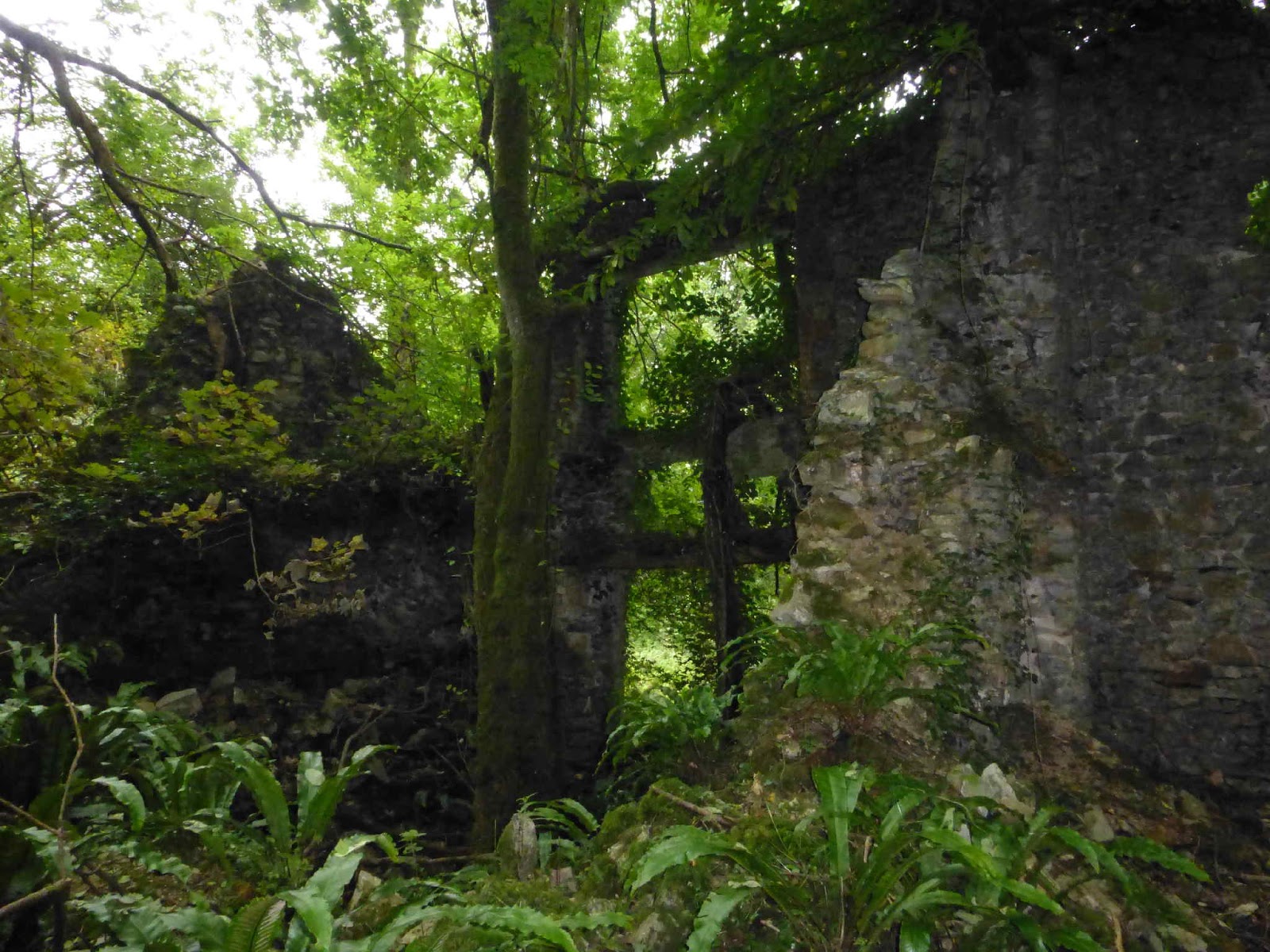
Since then nature has reclaimed the site and now trees grow where there were once grand rooms.  Sometime after 2000 the last remaining part of the front elevation collapsed into a heap of rubble.  The house is still rather optimistically marked on the 1:25,000 scale Ordnance Survey map.

An avenue of yew trees is still growing as you approach along a path from the east.  However other trees have now grown up around them.  The former stable block and coach house, which lie to the west of the main house, have been converted into houses. 

My thanks to Sue for taking the photos below for me.

Further Reading: Ashwick: Coal, Ale and Pasture - edited by Penny Stokes.  Published by Mendip District Council, 2002. 

Ferns are thriving in the ruins

 One of the few remaining walls still standing

 The remains of a garden wall?

 A jungle reclaims the house

Tuesday, 1 December 2015

The Dwarf's House, Bawdrip

The Dwarf's House is located on Church Road in Bawdrip. There is very little written about it and no one seems to know why it is so small - its external measurements are 13 feet long by 9 feet wide and 13 feet high.  It has 2 floors and the front door is only 4 feet 10 inches high.  It is no longer used as a house.  Grid Reference ST 342 395.

 Dwarf's House, Bawdrip

Village Animal Pounds

Animal pounds were secure enclosed areas where trespassing animals (usually cattle, horses, pigs or sheep) were impounded until their owners paid a fine or they were released as a result of a court judgment.    Most medieval villages had an animal pound. The man in charge of impounding the stray animals was paid by the Lord of the Manor and was known as a pinder or pounder.  Fines and disputes are documented in manorial court records.

In the medieval period the field system in use was an open one, so it would have been easy for animals to stray onto a neighbour's land.  Animals grazing unlawfully on common land could also be impounded.  If a person owed a debt to another person, their animals might also be impounded until the debt was paid. 

The word pound comes from the Old English word pund, meaning a pen or enclosure.  In parts of Scotland e.g. Shetland the word pund is still used.   The term pinfold is used in some parts of Britain instead of pound e.g. in the north and east of England.

Pounds were often sited near village greens, churches or crossroads to enable local residents to check if any of the impounded animals belonged to them. They were used up until farmland was enclosed in the 17th to 19th centuries.   

In some places the pounds were probably enclosed by hedges or wooden hurdles/rails and these have long since disappeared.  Some places had brick or stone animal pounds and a few of these have survived.  However some of the surviving pounds have at a later date been incorporated into neighbouring properties and so are no longer recognisable as animal pounds.

Not many examples of animal pounds survive in Somerset. The ones I am aware of are at Holford (dog pound), Crowcombe, Oakhill, Brompton Regis, Chaffcombe and Stogursey.  There is also one in North Somerset at Hutton.

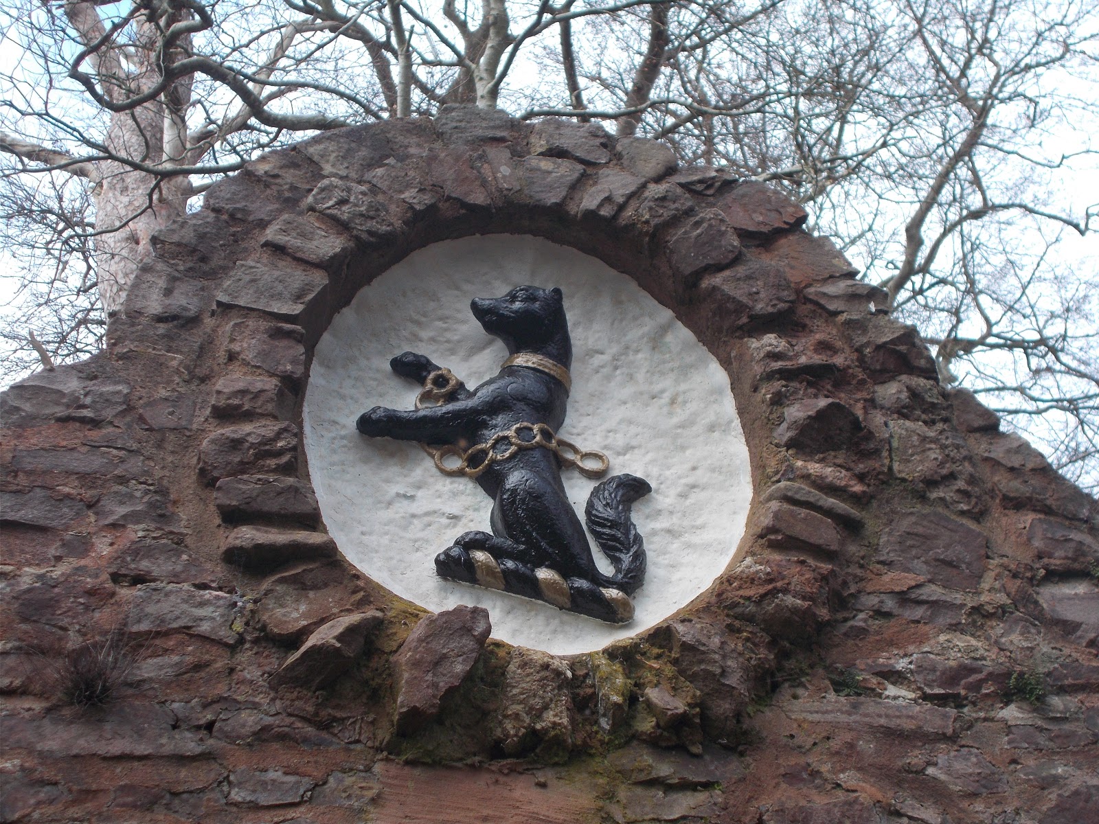
The (possibly apocryphal) story behind the Holford Dog Pound is that at some unspecfiied time in the past the pack of hounds used in hunts were kept on the Alfoxton estate.  Meat which would be used to feed them, was stored hung high in trees out of their reach until it was needed.  However the meat attracted local stray dogs.  One night the hounds were disturbed by the local strays and the huntsman who normally looked after the dogs went out to see what the matter was.  However he did not put on the clothes he normally wore to do this.  This meant that the hounds did not recognise him and they attacked and killed him.  The dog pound was built, so that local stray dogs could be rounded up and incarcerated, so that they wouldn't disturb the hounds.  The plaque below the dog crest reads: "This ancient dog pound was given to the village of Holford in 1982 by the family of the late John Lancelot Brereton, descendants of the St Albyns, owners of Alfoxton since the 15th century, whose crest appears above."

Crowcombe has had an animal pound since at least 1642 when it was first mentioned in official records.  It was used up until the 1920s or 1930s.  It was restored in 2004 by Crowcombe Women's Institute.  The large fern growing inside it is at least 60 years old.

 Dog pound at Holford

Recently repainted Brereton family crest on the Holford Dog Pound - December 2019

Entrance to the animal pound at Crowcombe

 Captive fern in Crowcombe Pound!

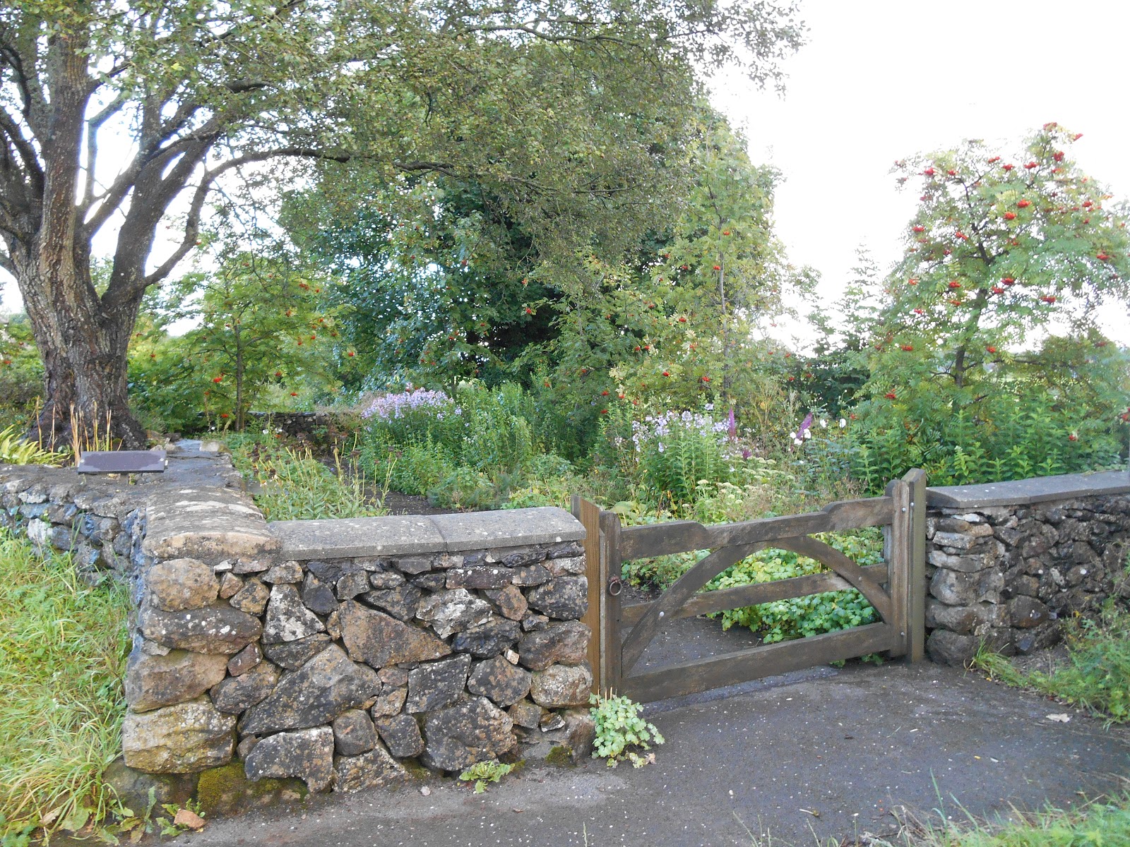
 Oakhill - the pound has been converted into a lovely garden

 Oakhill Animal Pound

 Plaque on Oakhill Pound


 I think this is the remains of the animal pound at Brompton Regis.  It is located behind the village lock up 
 Brompton Regis - lock ups for humans and animals

Entrance to Stogursey's animal pound
 - a dog waits patiently to be claimed by his owner. 

 Stogursey's Animal Pound
The pound is located on the corner of Castle Street and St Andrew's Road. There is a small garden inside it but it was locked on the day I visited in December 2015.
 
Chaffcombe
The pound here has been turned into a community garden with a strange colourful sculpture in the middle of it, a bench and some apple trees

Pound Cottage, Chaffcombe
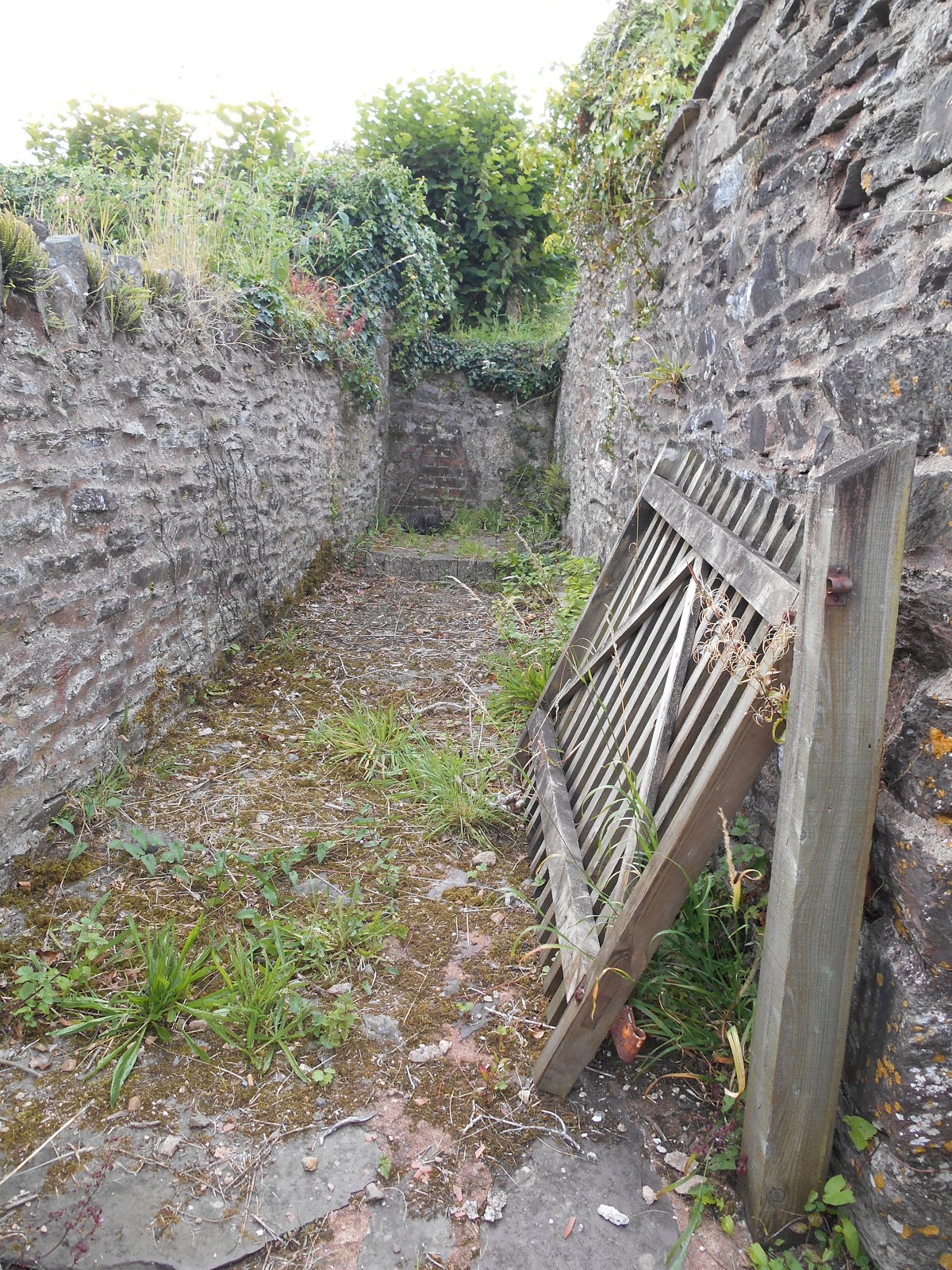
 The overgrown wall in the foreground was part of the village's animal pound.

Pound in Great Elm Road, Mells

Hutton Parish Pound

Hutton's Parish Pound

Stone and plaque (placed there in 2000) at the site of Lympsham's village pound and Manor Farm.

West Bagborough's pound
This was restored in 2000

Burrington
This pound on Fry's Lane dates from 1838-1888

Butcher's Hill, Fivehead

Sunday, 22 November 2015

Lion Rock, Cheddar Gorge

Lion Rock is located at the bottom of the west side of the limestone Cheddar Gorge behind the appropriately named Lion Rock Tearooms.

Lion Rock is a mimetolith: a natural topographical feature or rock outcrop/specimen which resembles something else - usually a person or an animal.  This word hasn't yet made it into the Oxford English Dictionary but I have come across it in several places e.g. the German soldier's head on the A9 at Slochd in the Scottish Highlands.  The Ally Sloper rock on the island of Lundy is another example.  I think mimetolith is a recently made up word comprised of the Greek words for imitator (mimetes) and rock (lithos). I'm not sure who invented the term but it is a good one that fills a gap in the English language and deserves to be made official!

Cheddar's Lion Rock resembles a crouching lion.  It has obviously been called Lion Rock for some time, as it is marked on the 1:25,000 scale Ordnance Survey map.   Grid Reference ST 466 540


 Lion Rock - it's not that clear from a distance

  Can you see his face?


Who put that telegraph pole there!

Churchyard without a Church, West Dowlish

500 metres to the south of the hamlet of Moolham, 200 metres to the west of Moolham Lane, a mile west of Dowlish Wake and bounded on 2 sides by an orchard, is a small isolated graveyard. It isn't even marked on the 1:50,000 scale Ordnance Survey map, although it is marked on the 1:25,000 scale Explorer map.  There is no sign of a church.  The graveyard contains a dozen or so old graves and about half a dozen more recent ones, including those of Baron Peter Pilkington of Oxenford and his wife Helen, who died in 2011 and 1997 respectively.

This is the churchyard of the long gone St John the Baptist Church, West Dowlish.  According to the Victoria County History of Somerset  the church had been demolished by 1575 and the rectory was annexed to Dowlish Wake in 1857.  Collinson's 1791 History and Antiquities of the County of Somerset noted that the church had been ruined for a century, that the churchyard was overgrown and the font had been moved to Dowlish Wake Church.  The church may have been destroyed by a fire.

Grid Reference: ST 362 130


 Graveyard of St John the Baptist, West Dowlish
 
I did wonder if the occupant of this tomb had escaped!

Saxon font from West Dowlish Church, now in St Andrew's Church, Dowlish Wake 

Thursday, 12 November 2015

Hurdle Stack, Priddy

A thatched hurdle stack stands on Priddy Green.  It is a symbolic collection of wooden hurdles that were used to form the sheep pens at Priddy Sheep Fair up until just after the Second World War.  After this time metal hurdles were used.  The hurdle stack was rebuilt a couple of times after the hurdles rotted. It was rebuilt in 1997 but was burnt down in an arson attack in April 2013.  It was rebuilt in July 2013.  It contains 130 ash hurdles.  It was previously thatched with straw but is currently thatched with reed, which lasts longer.

Priddy Sheep Fair was moved from Wells to Priddy in 1348 during the Black Death.  Presumably either the good people of Wells didn't want it back or no one has told them that the Black Death hasn't been a problem for several centuries!  No fair was held during 2001 (foot and mouth), 2007, 2012 (endless rain), 2014 (health and safety requirements and the cost of road closures) or 2015 (the organising committee resigned).

 Hurdle Stack on Priddy Green


The plaque on the hurdle stack reads:

"These hurdles are a symbolic reconstruction of the original collection.  They were stored here to form the Pens for the Sheep Fair, which moved from Wells to Priddy in 1348 at the outbreak of the Black Death.  

The fair is now held annually on the nearest Wednesday to the original date of the 21st August.

The hurdle stack was destroyed by fire on 28th April 2013 and rebuilt by volunteers from the Parish in July 2013."

Lorna Doone

Lorna Doone is a very long novel by Richard Doddridge Blackmore (1825-1900), which was first published in 1869.  It is a romance set in the late 17th century around the Badgworthy Water area of Exmoor. 

In 1673 12 year old John Ridd's farmer father is killed by Carver Doone.   The Doones are a family of outlaws who live in the isolated Doone Valley and terrorise the area. He vows to avenge his father's death.  He falls in love with Lorna Doone but so does Carver Doone.  After he is himself attacked by the Doones, John's uncle Reuben Huckaback gets Judge Jeffreys to help fight the Doones.  John rescues Lorna from the Doones during a blizzard.

A short time later the Monmouth Rebellion takes place and John is wrongly accused of fighting with the Duke of Monmouth against King James II.  He is rescued before he is hanged and is made a knight after he prevents an attack on Lorna's uncle. The Doones are attacked and all are killed except for Carver. 

It turns out that Lorna is not a Doone at all but was kidnapped by the Doones as a young girl and is in fact the daughter of a wealthy lord. At John and Lorna's wedding in Oare Church, Carver shoots Lorna.  He is chased into a bog by John and dies.  Lorna recovers and they live happily ever after. 


 Lorna Doone's Statue in Dulverton
This statue was made by Professor George Stephenson. It was commissioned by Dr Whitman Pearson of the USA and donated to the town of Dulverton in 1990

Lorna Doone celebrates the Queen's Platinum Jubilee with a Union Jack in her hand, June 2022

Lank Combe, Exmoor
 This is thought to be the location of the fictional Doone Valley

Memorial to R.D. Blackmore on the banks of Badgworthy Water, Exmoor.
It was erected in 1969 to mark the centenary of the publication of Lorna Doone.


 Nave of Oare Church
 - Lorna was shot by Carver Doone while standing at the altar.


 Window in Oare Church through which Lorna Doone was shot


 Oare Church
 
Water slide in the Lank Combe Stream where John and Lorna meet for the first time

Richard Doddridge Blackmore's Memorial Plaque on the wall of Oare Church

Gravestone of a real life Lorna Doone Ridd in the churchyard at Martinhoe in North Devon
She died in 1955 aged 75.