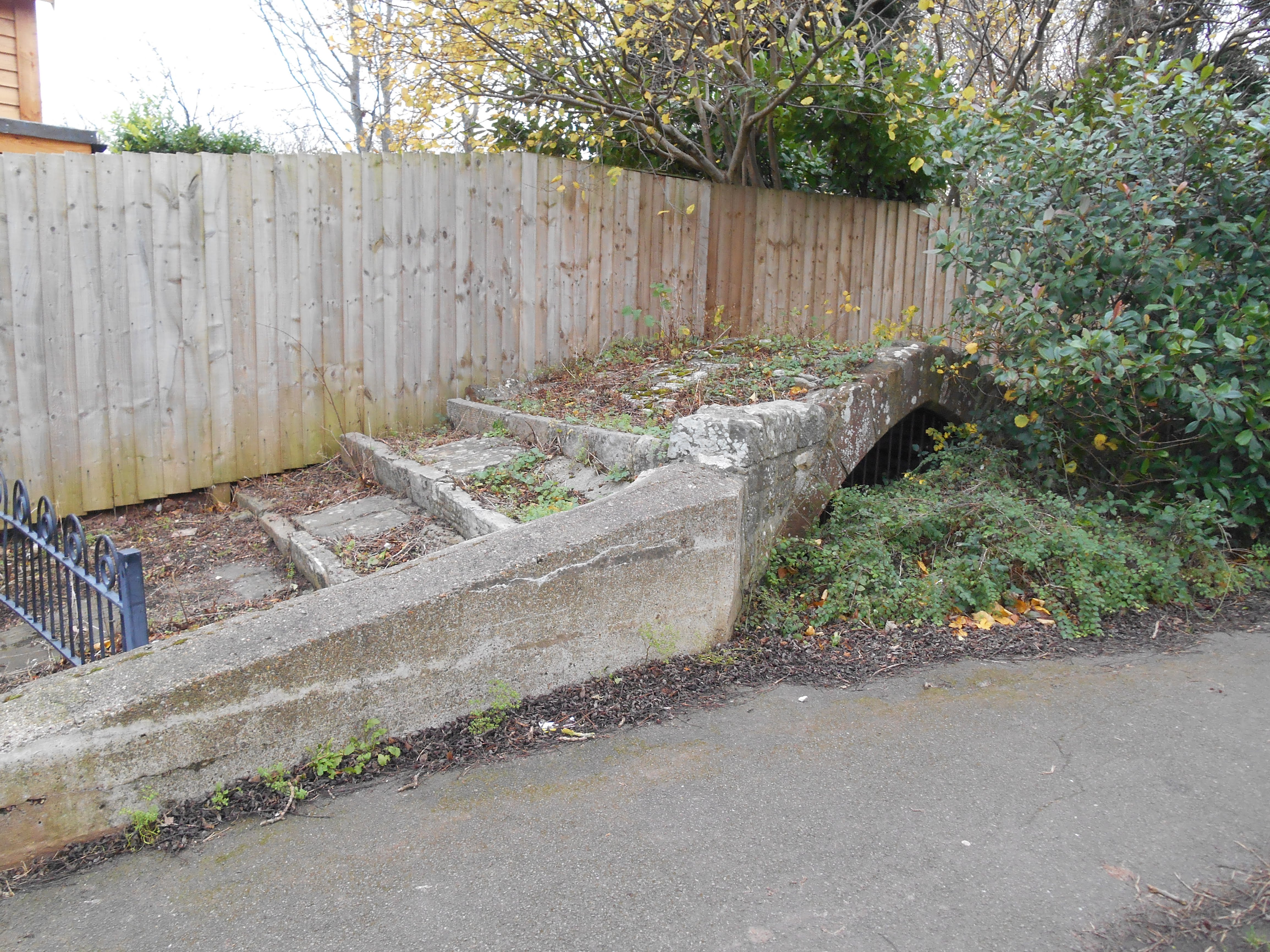
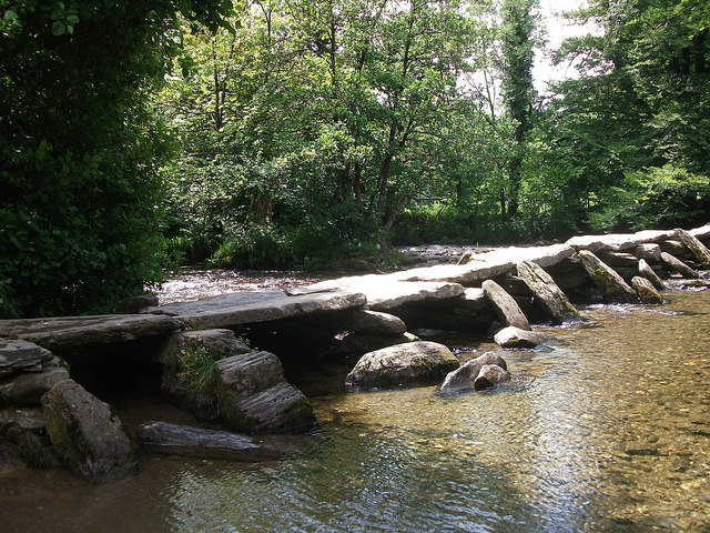
Showing posts with label Bridges. Show all posts

Friday, 1 May 2026

Shurton: village of many footbridges

The small village of Shurton near Stogursey has five interesting stone footbridges over Bayley's Brook, which runs through the village.  The bridges are close together.  The one leading to Ashforde House is definitely private.  I think the one next to Thatch End is too.  The other three are definitely public.  Two have single spans and one has a double span.

Single-span footbridge

Double-span footbridge

Another single-span footbridge

This private bridge leads to Ashforde House

I think this 18th century bridge next to a house called Thatch End is private.

Friday, 1 September 2023

Packhorse Bridges

Packhorse bridges were built so that horses and ponies carrying loads could cross rivers and streams.  Most were built before c1800 and are just wide enough for one laden horse to pass over them.  Many of them were originally cobbled and they often have low parapets, so that they didn't interfere with the panniers carried by the horses.  Somerset has about 30 surviving examples, many of them on Exmoor because the bulk of goods were carried by packhorses in upland areas.

Gallox Bridge, Dunster - over the River Avill
This double-arched bridge possibly dates back to the late 15th century. It linked the market town of Dunster to the wool-producing pasture land to the south.  Pedestrians and packhorses used the bridge and carts crossed the River Avill using the ford adjacent to the bridge. The bridge takes its name from the gallows, which used to be located on nearby Gallox Hill.

Allerford - over the River Aller

Allerford's medieval packhorse bridge

Hacketty Bridge, Horner - over the Horner Water
This bridge possibly dates back to the late medieval period

Hacketty Way Bridge, Horner

West Luccombe - over the Horner Water
This bridge was built in the late medieval period

West Luccombe

Ramshorn Bridge, Taunton
The Galmington Stream has been diverted and no longer flows under this bridge.

Bow Bridge, Bruton - over the River Brue

Bow Bridge, Bruton

Kentsford Farm, Watchet - over the Washford River

Robber's Bridge - over the Weir Water

Bury Bridge - over the River Haddeo

Bury Bridge

Bury Bridge and Ford
Medieval four-arched bridge

Malmsmead Packhorse Bridge and Ford over the Badgworthy Water
This bridge was built in the 17th century

Smithy Bridge, Winsford - over the Winn Brook
This single arch packhorse bridge dates back to the medieval period and was restored in 1952.

Packhorse bridge next to Vicarage Bridge, Winsford
This two-arched bridge is probably medieval in origin.  It was rebuilt in 1952 following flood damage.

Packhorse bridge next to Vicarage Bridge, Winsford

Edbrooke Packhorse Bridge over the River Exe near Winsford
This bridge is probably medieval in origin but was rebuilt in the 18th century.  The road to Winsford passed over the bridge until the new turnpike road was cut in 1824

Edbrooke Bridge

 Packhorse bridge at Marsh Bridge Cross
This packhorse bridge was built sometime before 1838.

Marshbridge Cross Packhorse Bridge

Cannington Packhorse Bridge over the Cannington Brook

Cannington Packhorse Bridge

Wellow Packhorse Bridge
This was built across the Wellow Brook in the late medieval period but has been restored and altered since then.

Bolter's Bridge

Bolter's Bridge

Bolter's Bridge, which spans the River Alham, is located half a mile south east of the hamlet of Hornblotton.  It is on the border between the parishes of Ditcheat and West Bradley.  It was reputedly built in the medieval period by the Abbots of Glastonbury to join two parts of the moor and to make a road from Castle Cary to Glastonbury.  It has 4 arches and no parapets.
Grid reference: ST 606 334.

Dowlish Wake
This packhorse bridge was built in the 17th or 18th century using the local Moolham stone from an earlier (14th or 15th century) bridge.  The arches on the right and left hand sides were inserted in 1997, as part of a flood relief scheme.

Chew Stoke
This two-arched bridge may date from the 17th or 18th century.

Saturday, 3 April 2021

Hinkley Point's Bat Bridge

Part of a mature hedgerow in the middle of the Hinkley Point C site, known as Green Lane,  was removed in the early phase of the construction project.  This meant that the local barbastelle bats were no longer able to use it as a navigation corridor to guide them to their feeding areas.  Barbastelle bats are extremely rare and protected by law, so a "bat bridge"  was constructed by the company Kier on the line of Green Lane, so that the bats could echolocate their way along it.  A bat house was built to the south of the site to provide bats with a place to roost and hibernate.

Bat bridge viewed from outside the construction site, December 2016

Bat bridge at Hinkley Point

Thursday, 14 November 2019

Monkey Bridge, Tickenham

In 2013 Tickenham Parish Council erected a plaque on the bridge to the south west of the parish church and on the unclassified road that runs south to Nailsea across Tickenham Moor.  The wording on the plaque reads as follows:

Monkey Bridge (formerly Church Bridge)

On Tuesday 13th March 1906 Bostock and Wombwell’s Travelling Menagerie attempted to cross this bridge having already failed to climb the main road by Jacklands Bridge because of ice. The horse-drawn carriage with monkeys on board fell into the rhyne: the elephants and horses tried but failed to free the wagon.  Eventually a local traction engine succeeded and they continued on their way to Clevedon that night.  All animals are believed to have survived the incident.

Plaque on Monkey Bridge

Monkey Bridge looking north east toward the Church of St Quiricus and St Julietta

Monkey Bridge looking south towards Nailsea across Tickenham Moor

Monday, 16 September 2019

Swing Bridge, Bow Street, Langport

Outside the former Railway Hotel on the west side of the River Parrett in Bow Street, Langport Westover, there is a very unusual iron swing footbridge.  

Until 1853, when the railway line from Durston to Yeovil via Langport was built, the turnpike road through Langport went past the door of the hotel, which was a pub at this time.  However the level of the turnpike road (now the A378) had to be raised so that it could cross over the railway line, which ran in a NNW-SSE direction.  The road was slightly re-aligned and embanked from the west end of Bow Bridge and a vertical stone retaining wall was built on the northern side of the embankment. The original turnpike road then became an access road to warehouses on the west side of the pub.  

The Railway Hotel was built in 1906 on the site of an earlier pub, which had burnt down.  It was decided to have the main door on the first floor, which was roughly level with the pavement of the raised main road.  However a fixed bridge would have been too low for vehicles using the access road to pass underneath it and there wasn't enough space for a conventional swing bridge.  A swing bridge comprised of two sections, which swing and close together like scissors, was the solution.  The bridge was opened and closed using a hand crank.  It is no longer in use.  The hotel was converted into six flats in the late 1980s.


Swing bridge, Bow Street, Langport

Swing bridge mechanism

Door on the first floor of the former Railway Hotel, Langport

Wednesday, 4 January 2017

Tarr No Steps

Tarr Steps is an ancient 17 span clapper bridge, which normally straddles the River Barle between Dulverton and Withypool.  However on 20th/21st November 2016 about a third of it was washed away by heavy rainfall that accompanied Storm Angus.  It has been washed away  and subsequently rebuilt on several previous occasions, including 1939, 1952, 1979 and 2012.

Tarr Steps, which is possibly Britain's longest clapper bridge (38.5 metres measured between the river banks or 58 metres if the stone causeways at each end are included), probably dates from the 15th or 16th centuries but it may be much older (Bronze Age or medieval).  Local legend says that Tarr Steps was built by the devil.  The Tarr part of the name may come from the word "torri" meaning "to break" and in this case referring to a rough or violent stream 

The term clapper comes from the Latin "claperius" meaning "pile of stones".  In a clapper bridge large unmortared stone slabs rest on one another. The stones used to build the bridge are local gritstones, probably from Pickwell Down. 

Tarr Steps is made of three components:
  • Clappers: stone slabs, which form the causeway
  • Piers: these rest on the river bed and support the clappers
  • Raking stones or catchwaters: these are placed against the piers to protect them and the clappers from the strong currents in the river by deflecting water and debris under the bridge or over it in times of flood.
Cables were strung across the river upstream of Tarr Steps at some point after the 1952 floods.  The purpose of these is to catch debris like tree trunks and branches, thereby preventing them from hitting Tarr Steps and dislodging the stones.  However in 2012 the cables were destroyed by the floodwater and debris.

December 2016: the parts are all there but are currently scattered around the riverbed

December 2016: Mind the Gap!

Gap in the middle of Tarr Steps
 
What Tarr Steps normally looks like
 
Tarr Steps on a calm sunny day in 2016
 
West Somerset Ramblers on Tarr Steps, December 2016
The debris of tree trunks and branches can clearly be seen.

Friday, 23 October 2015

Bridge over the Avenue at Stream

This packhorse style stone bridge is alongside a stream near the hamlet of Stream.  However it does not cross the stream - it was built to carry the public footpath over the driveway to Orchard Wyndham House.  Today the driveway is no longer used, so the bridge is superfluous.  It is not a listed structure and I have not been able to find out when it was built.  Orchard Wyndham House is medieval in origin but was enlarged in the 15th and 17th centuries and altered in the 19th century.  It is open to the public on designated days during the summer months and to larger parties of people by arrangement.

 Bridge from below

 Looking west over the bridge

 Looking east

View under the bridge
 
Access via a kissing gate onto the bridge from the east side
 
Looking south down the driveway from below the bridge
 
Looking west over the bridge

Looking south down the avenue from the top of the bridge and over the bridge that does cross the stream