Saturday, 16 June 2018

Oh Deer!

While walking on the Quantock Hills and Exmoor I have seen many live red deer and the occasional roe deer.  However this blogpost is dedicated to artistic representations.  These are the ones I have come across so far:

Fawn by artist Fawn, Weston-Super-Mare


Stag Statue at West Quantoxhead

Willow Stag, Nynehead Court

Stag on bench end in Bishops Lydeard Church

Stag statue next to the "Welcome to Minehead" sign at the Ellicombe Roundabout

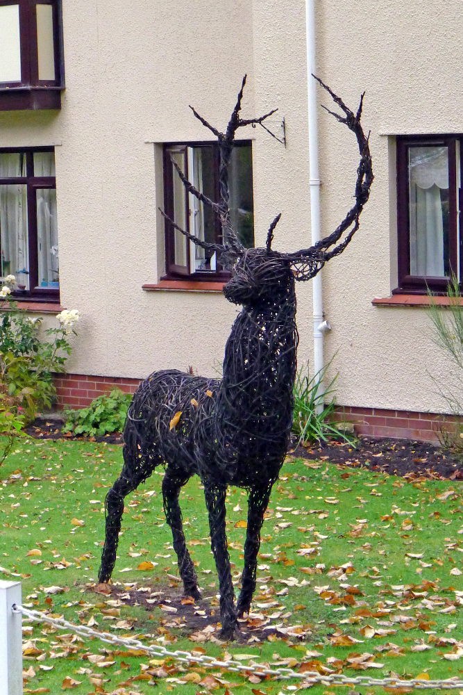
This stag lives in the garden of some retirement flats in Dulverton

Horatio
This stag, who is called Horatio, can be found in the grounds of Minehead Middle School in Ponsford Road.  He was carved with a chainsaw in the summer of 2016 by Matthew Crabb, who is a former pupil of the school and is now a renowned chainsaw artist.  The sculpture is 10 feet tall and was commissioned to celebrate the launch of the West Somerset Academies Trust.

Gate at Dunster Village Gardens

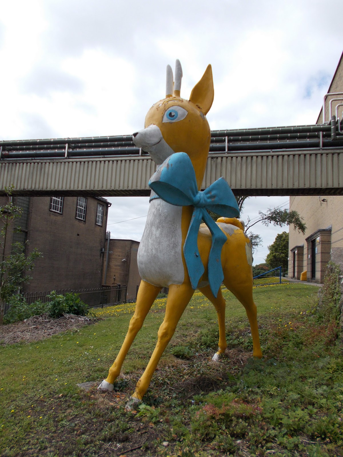
Showering's trademark Babycham statue outside Showerings Cider Mill (now the Brothers Drinks' Factory) in Kilver Street, Shepton Mallet


Babycham is a light sparkling perry launched in the UK by Francis Showering in 1953 and first produced at Showerings Cider Mill in Shepton Mallet.  It was a particularly popular drink in the 1960s and 1970s and a chamois goat/antelope logo was used to market it.  The Babycham brand is now owned by an Australian company: Accolade Wines.

This stag is part of the Wildwood mural in an alleyway just off Glastonbury High Street

Stag weather vane on the roof of Dulverton Cricket Club

Stag on the back of a seat at Kingston St Mary

Stag on a bench end in Monksilver Church

Red deer on a kneeler in Exford Church

Stag at the Cartgate Picnic Site on the A303

The White Hart public house, Somerton

Queen Elizabeth II's Platinum Jubilee seat, Somerton

Forefront Community Centre & Church, Fore Street, Chard

Nynehead Court

Friday, 1 June 2018

Automobile Association Village Signs

From 1906 to 1939, the Automobile Association erected nearly 30,000 signs in towns and villages across Britain. As well as giving the name of the town or village in which they were situated, they also gave the distances to the nearest towns or villages and to London. 

The first sign to be erected was on the Great North Road at Hatfield in Hertfordshire.  Designs of the signs varied over time but they were always yellow and black in colour and circular.

Most of the AA signs were removed during the Second World War when signposts across Britain were removed to confuse the Germans in the event of an invasion.  By 1945 only about 600 were left and today there are only around 65 still in place in England and Wales. Many more have survived in museums and private collections.  It is also possible to buy replica signs (if you have £290-£470 to spare) and I think that at least one of the ones I have spotted in Somerset is in fact a replica.

I have spotted original signs in Halse, Pitney, Stawell, Milverton, Lydeard St Lawrence, Muchelney and Clapton and replica signs in Stembridge, Upton and Wearne.  I have seen photos online of a sign in Staple Fitzpaine.  However I have not noticed it when I have visited the village and cannot see it on Google Street View and so presume it has been removed in the last few years.

As you drive into Winsham on the B3162 from Chard there is a very rare Somerset Automobile Club sign asking you to "drive slowly".  There was an identical sign on the southern outskirts of the village but it wasn't there when I visited in February 2018.  I think I could see the post to which it was attached.  I don't know if it has been stolen or taken down for repair.  36 of these privately financed signs were apparently accepted by Somerset County Council in 1907 and one was ordered by Chard Rural District Council for Winsham in 1911. They were cast by W. and F. Wills, Engineers of Bridgwater.  Apparently the reverse side says "thank you", although you can't see the back of the sign I photographed due to the hedge growing immediately behind it.  I have subsequently  photographed 3 other Somerset Automobile Club signs in Ashill, Freshford and North Street, Stoke sub Hamdon.  

Elworthy and Monksilver both have very old Somerset County Council signs, which are similar in design to the Somerset Automobile Club ones.

Halse

Stembridge - I think this is a replica


Pitney

Rare Somerset Automobile Club Sign on the north side of Winsham

AA sign, Clapton

AA Sign on the former Blue Boy Inn, Clapton

The Old Post Office, Stawell

AA sign and George V postbox, Stawell

Barn at Charity Farm, Hermitage Road, Upton

Somerset Automobile Club sign, Windmill Hill Lane, Ashill

Somerset Automobile Club sign in North Street, Stoke sub Hamdon

Stoke sub Hamdon SAC sign

Somerset Automobile Club sign near the bridge over the River Frome in Freshford

Somerset Automobile Club sign in Langford Road, Lower Langford

AA sign on The Globe pub in Milverton

AA sign on The Globe pub in Milverton

Somerset County Council sign at the south end of Monksilver

Somerset County Council sign at the north end of Monksilver

Somerset County Council sign at Elworthy

Wearne replica AA sign

AA sign, Lydeard St Lawrence

AA sign, Muchelney

Tuesday, 15 May 2018

Milestones and Mileposts

Milestones and mileposts are stones or short pillars set up at the roadside indicating the distance in miles from that point to a particular place or places.  The first milestones in England were erected by the Romans, who constructed good metalled roads to enable them to move soldiers and supplies quickly across the country.  They measured out distances to assist with timing and efficiency and marked every 1,000 double paces with a large cylindrical stone. 117 of these stones still survive in the UK, although most of them are no longer in their original locations. The Latin word for thousand is ‘mille’ and the Roman mile was 1618 yards long. In England the statute mile of 1,760 yards was defined by Act of Parliament in 1593 but various other miles continued in use in many parts of Britain until the 19th century. 

In 1697 an Act of Parliament enabled Justices of the Peace to order the erection of inscribed waymarkers known as guide stoops, guideposts or direction stones at the intersection of paths in remote moorland areas.  These stone guide stoops, which often resembled farm gateposts, pointed the way to the nearest market town.

From the late 17th century to the 1840s Turnpike Trusts were set up by Acts of Parliament to improve the state of Britain’s roads, which often became impassable in the winter months. Local groups of wealthy people paid for improved roads to be built and then charged people tolls for using them. The turnpike milestones of the 18th and early 19th centuries used statute miles. At first these milestones were made of stone or were engraved in walls of buildings but the later ones were made of cast iron. After 1767 milestones were compulsory on all turnpike roads to inform travellers, to help coaches keep to schedules and for the calculation of charges for the changes of horses at coaching inns.

Most milestones and mileposts were removed or defaced at the beginning of the Second World War to confuse the Germans in the event of an invasion and not all were replaced afterwards.  Some have been demolished more recently during road widening schemes and others have been damaged by vehicles colliding with them or by hedge cutting equipment.  However several have survived in Somerset.


Milestone, Cothelstone Hill

Cast iron milepost, Shoreditch, near Taunton Racecourse
Honiton 16 miles, Taunton 2 miles

Cast iron sign mounted on a wall in Curry Rivel

Cothelstone
(it's a shame they couldn't spell Bridgwater!)

Bath Turnpike Trust milepost, Widcombe, Bath

Bath Turnpike Trust's 1827 milepost on the A367 at Odd Down
This marks the boundary between the parishes of Combe Hay and Englishcombe.

Bath Turnpike Trust's 1827 milepost on the A367 at Odd Down
This marks the former boundary between the parishes of Widcombe and Combe Hay

Simple milestone, Church Street (B3162), Winsham

Replica milestone, A396 at Wheddon Cross
It has the date 2005 on it.

A39 at Coxley near Wells
2 miles to Wells, 4 miles to Glastonbury and 18 miles to Bridgwater

Cast iron milepost on Church Street (A366), 
Norton St Philip
6 miles to Trowbridge, 16 to Devizes, 17 to Wells and 105 to London

Direction stone, West Chinnock
This direction stone is located at the junction of Smoky Hole Lane and Smith's Hill and is made of Ham stone.  It is thought to date from 1745 or 1749.  On the south face an inscribed cuffed hand points east to EAST/NNICK (East Chinnock) and another hand points west to CREWKE/RNE ROAD.  On the east face a hand points north to YEOVIL/ROAD. The distances are not given.

Milestone outside Shoreditch Farm

Replica milestone, Kingston Road, Kingston St Mary
It has the date 2007 on it.

Milestone by the side of Honiton Road in Blagdon Hill

Milestone in Brook Street, Bampton, Devon
It is very precise as to how far away Minehead is: 22 miles, 5 P (poles or perches - is is definitely a P but should it be F for furlong?) and 34 R (rods)

Bristol Turnpike Trust's 1823 cast iron milepost and an earlier milestone on the A370 at Chelvey Batch

Somerset County Council’s 1911 milepost in Clevedon Road, Tickenham

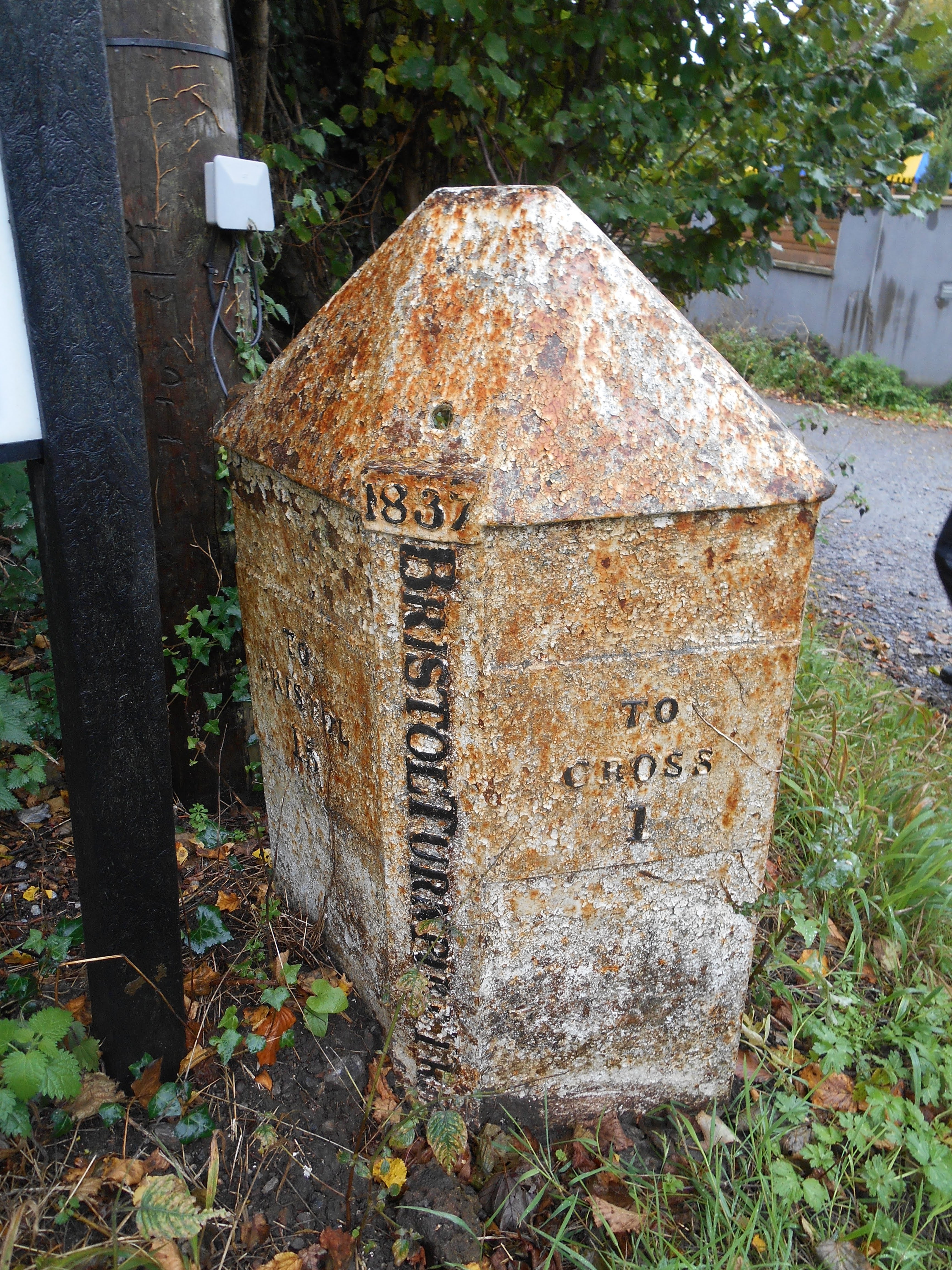
Bristol Turnpike Trust's 1837 cast iron milepost in Clevedon Road, Nailsea

Bristol Turnpike Trust Milepost on the A38 at Langford

Bristol Turnpike Trust Milepost, A38, Fullers Lane, Sidcot

1733 Bristol Rode guidestone at the junction of Clapton Lane and Clevedon Road, Portishead

Modern milestone in Halberton, Devon: 11 miles to Wellington

Milestone in High Street, Ilchester 
Miles to London 127,  Bristol 35, Bath (illegible) 33, Wells 18, Taunton 24, Yeovil 5

A3066, Haselbury Plucknett

Cannard's Grave Road (A371), Shepton Mallet

Market Cross, Shepton Mallet

Middle Road, Cossington
4 miles to Bridgwater

Staple Fitzpaine
5 miles to Taunton

A361 between West Pennard and Pilton
Taunton 26, Shepton Mallet 4, Glastonbury 5

New Cross
Langport 6, Crewkerne 7