Tuesday, 1 November 2016

Royal Observer Corps Monitoring Posts

The Observer Corps was set up in 1925 but had its roots in the First World War.  The need for an organised early warning system was recognised when the Germans started aerial bombing raids on southern England using Zeppelin airships in 1915. A network of observers stationed at strategic locations was set up.

During the 1930s the number of observation posts was greatly increased until by 1939 the whole of Britain was covered by the network. During the Battle of Britain in 1940 the Corps plotted the positions of German aircraft and passed the information to the RAF.  To recognise the value of this work, on 9th April 1941 King George VI conferred the title Royal on the Observer Corps.  Women were allowed to join the ROC from July 1941.

From 1940-42 a network of 150 satellite posts was established to improve coverage along the south and east coasts of Britain as far north as Dundee and on the coasts of Lancashire and Cheshire.  Some of these posts were manned by the ROC but most were manned by the RAF, coastguards or Anti-Aircraft Command.

The ROC was temporarily stood down on 12th May 1945 but was reactivated in 1947 in response to post war threats from the Soviet Bloc.  In 1951-2 some ROC Monitoring Sites were provided with brick or pre-cast concrete shelters above ground, which offered some shelter against the weather and attack from aircraft.  The pre-cast concrete shelters were known as Orlit Posts after the company, which had the contract to produce them: Messrs Orlit Ltd.  There are two types of Orlit Post - type 'A', which are on the ground and 'B', which are raised 6 feet above the ground on 4 legs, with a ladder for access.

In 1955 the ROC was given responsibility for giving warning of air attacks in a future war and to measure radioactivity levels in the event of a nuclear attack. The above ground monitoring posts offered little protection from radioactivity.  Therefore a programme of works was developed to build a network of underground posts.  By 1964 1,563 underground posts had been constructed across the UK.  They were designed to provide satisfactory blast protection and to be able to be used self-sufficiently for a number of weeks if a nuclear attack on the UK had occurred. On the surface there is usually an entrance shaft and a separate ventilation shaft a few feet away.

Cuts in defence spending reduced the number of ROC posts to 873 in 1968. With the final end to the Cold War and more cuts in defence spending the ROC was finally stood down on 30th September 1991.

In Somerset ROC Underground Monitoring Posts were located at Exford, Minehead (North Hill), Dunster (Beach), Holford, Lydeard St Lawrence, Dulverton, Wellington, Kingston St Mary, Puriton (at Pawlett), Hatch Beauchamp, Chard, Crewkerne, Ham Hill, Marston Magna, Templecombe, Bruton, Glastonbury, Langport,  Shepton Mallet, Frome, Westbury-sub-Mendip (Westbury Beacon) and Chilton Polden. In North Somerset they were located in Clevedon, Winscombe, Long Ashton, Bleadon and Portishead.

The following sites have been demolished and there are no visible remains: Glastonbury, Shepton Mallet, Bruton, Frome, Templecombe, Ham Hill, Minehead, Winscombe and Clevedon.  Some of the remaining sites are on private land and are therefore inaccessible.

So far I have visited Chard, Dunster, Exford, Puriton, Westbury-sub-Mendip, Bleadon and Portishead.  The site at Pawlett (ROC Puriton) is completely overgrown but those at Chard, Exford, Westbury-sub-Mendip, Bleadon, Portishead and Dunster are clearly visible if you know what you are looking for and where to look.

A comprehensive survey of the remains of all the ROC Monitoring Posts in the United Kingdom can be found on the Subterranea Britannica website: http://www.subbrit.org.uk/category/nuclear-monitoring-posts

A comprehensive history of the Royal Observer Corps can be found on the Royal Observer Corps Association’s website: http://www.roc-heritage.co.uk/roc-history.html 

Bleadon’s ROC Monitoring Post is now in the middle of a new golf course on the top of Bleadon Hill. It was built in 1959 and used until 1991. The access and ventilation shafts are both visible from a public footpath, which runs northwards from Roman Road. Grid reference: ST345 579

Chard ROC Post is located on Catch Gate Lane, Snowdon Hill just off the A30 half a mile to the west of Chard (grid reference ST309 091). It is not known what date it opened but it closed in 1991. It is particularly interesting, as it has an Orlit 'B' in addition to an underground chamber:

Entrance Shaft, ROC Chard

ROC Chard - Entrance Shaft

Orlit 'B' Post, ROC Chard
Dunster ROC Post was opened in 1962 and was operational until 1991.  It is located to the south of the coast path about 50 metres to the east of the public car park at Dunster Beach.  Grid reference: ST 005 444.

Dunster ROC Underground Monitoring Post, Dunster Beach

Puriton ROC Post is actually half a mile to the west of the village of Pawlett on the north side of Gaunts Road.  It opened in 1963 and closed in 1968. The site is very overgrown and even in winter it was very difficult to see.  Grid reference: ST291 431

ROC Puriton - look hard!

Exford ROC Post is located in a field on the west side of the B3223 a few hundred metres north of the Chibbet Post crossroads (grid reference SS840 380).  It opened in 1961 and closed in 1991.

 ROC Exford
 
Access Shaft at ROC Exford

Westbury-sub-Mendip ROC Post is located at Westbury Beacon on the top of the Mendip Hills at a height of 269 metres above sea level.  It is mid way between the villages of Draycott and Westbury-sub-Mendip.  The post opened in April 1961 and closed in October 1968.  There is an Orlit 'A' about 30 metres from the underground post.  The access and ventilation shafts can be seen but they have been filled in with rubble and soil.

Orlit 'A' at ROC Westbury-sub-Mendip
 
Ventilation and access shafts at ROC Westbury-sub-Mendip
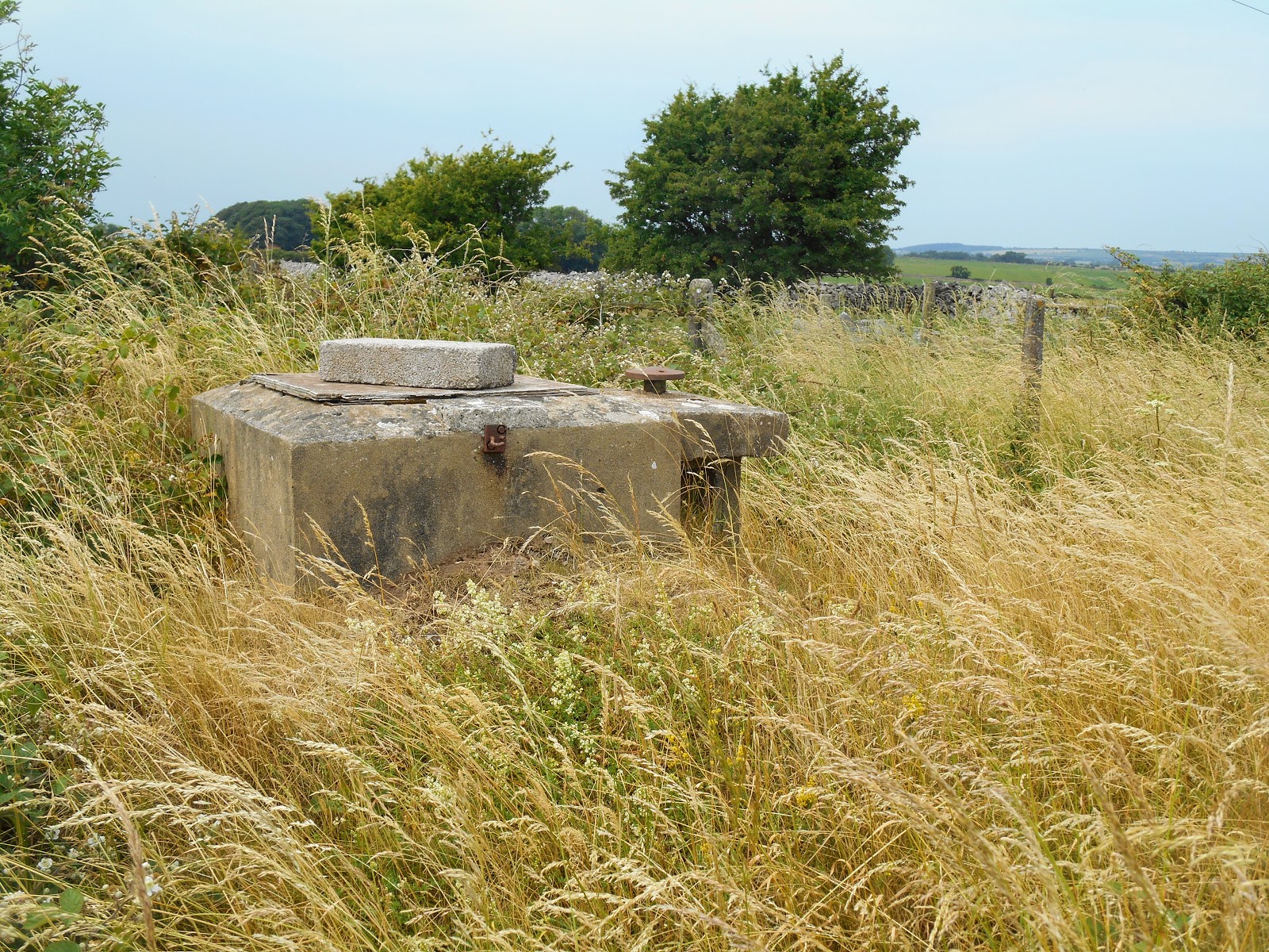
 
Access shaft at ROC Westbury-sub-Mendip

The very overgrown and truncated remains of the access shaft of Portishead ROC Monitoring Post can be seen in a small area of waste land on the south side of Down Road.  It was built in 1964 but closed down in 1968. Grid reference: ST448 759

Portishead ROC Post

Bleadon’s ROC Monitoring Post is now in the middle of a new golf course on the top of Bleadon Hill. It was built in 1959 and used until 1991. The access and ventilation shafts are both visible from a public footpath, which runs northwards from Roman Road. Grid reference: ST345 579

Bleadon ROC Post
 
Further Reading:
Attack Warning Red: The Royal Observer Corps and the Defence of Britain 1925 to 1992: Derek Wood.  Macdonald and Jane’s Publishers Limited, 1992

Thursday, 20 October 2016

Avishays Clock Tower, Chaffcombe

Avishays or Avishayes House (it seems to be spelt both ways in different sources) is located in the parish of Chaffcombe about half a mile south of the village.  It is also a mile to the east of the edge of the town of Chard.  The house was built in the 17th century but substantially altered 1745-59.  It was owned by the Sealy and Marwood families from 1697 until 1859 when it was sold to a Chard solicitor called Edward Clarke.

200 metres east of the house on Castle Hill and on the site of a ruined sham castle, a single storey decorative building was constructed from rubble stone and flint and dressed with Ham stone.  It was probably built for Edward Clarke  The parapet was castellated. It was a water tower supplying water to the house but also acted as an eye-catcher when viewed from the house. 

The building became known as the Monmouth Tower, in memory of Elias Sealy who owned Avishays at the time of the Monmouth Rebellion in 1685.  He supported Monmouth and narrowly avoided arrest after Monmouth's defeat at the Battle of Sedgemoor by hiding in a tree in the grounds of Avishays.  The tower is also known as The Castle.

The clock tower was apparently added to the top of the Monmouth Tower in around 1985 by the then owner of Avishays, David Cavender.  The chiming clock, which has only one face, was made by Gillet & Johnson of Croydon and dates from the 19th century.

At the time of writing in October 2016 the Avishays Estate (main house, coach house, 3 lodge houses, 2 cottages, outbuildings, Monmouth Tower and 90 acres of gardens, paddocks and parkland) is up for sale for £4.7 million.

Avishayes House
 
Monmouth Clock Tower

Romano-British Mosaic, Lopen

One evening in October 2001 George Caton was using a mechanical digger to create a new access road behind Mill Farm at Lopen near Ilminster for the Osborne family when he noticed some coloured cubes of stones.   He stopped work and the next day he and the Osbornes dug down and uncovered a small section of a Romano-British mosaic floor.  They contacted Somerset County Council's archaeological team and over the next three weeks the mosaic was fully excavated, cleaned, recorded and then covered over again to protect it from the elements. 

An 8-roomed villa was discovered, which is thought to date from about 360AD.  It was thought that the villa might have been altered at various times while it was in use. It probably had underfloor heating, as hypocaust bricks were found.  Part of it may have been two stories high.  The site is just over 1 km south of the Fosse Way, which runs from Lincoln to Exeter.  The room containing the mosaic was probably used for dining and entertaining guests.  The mosaic would have been laid to impress visitors.

The mosaic is believed to be the work of the Saltire School, who were based at Corinium (now Cirencester).  The designs used in the mosaic included large squares, saltires, a dolphin, a cantharus (two handled cup), flowers, fish, heart shaped leaves and guilloche (plaits or braids).  The southern part of the mosaic is almost 7 metres square, while the northern section is 4.5 metres square.

The tesserae used for the mosaic were almost all made from local stones:
  • Dark blue grey to light grey - blue lias
  • White - very pale blue lias or chalk
  • yellow-brown - inferior oolite (limestone stained by iron compounds)
  • sandy or pale yellow - inferior oolite
  • golden - Ham stone
  • red - terracotta cut from roof tiles or bricks
The mosaic was laid on a prepared surface with a layer of rubble at the bottom called the statutum. Above this was a layer of compacted rough mortar called the rudus.  Above this was a layer called the nucleus which consisted of powdered terracotta and mortar.  The top layer was fine mortar and the tesserae were laid on this.

The loose tesserae, which were found in the soil around the mosaic were donated to the village by the land owners and used to recreate a section of the mosaic.  Volunteers washed and sorted the pieces and Nicholas Durnan and Gina Wright placed the 3,000 or so pieces into lime mortar to create a cantharus.  It was completed in 2002 and is now on display on the floor of All Saints Church in Lopen.  The surround is made from Ham Stone.

 Reconstructed Mosaic in All Saints Church, Lopen

Reconstructed Cantharus Design

Thursday, 13 October 2016

The Underground Bunker, Chard

In 1938 construction of a massive underground concrete bomb proof bunker began in the garden of the Westminster Bank in Fore Street, Chard.  It was built by Sir Robert McAlpine & Sons and was finished in August 1939.  Its purpose was to store duplicate copies of the bank's customer records, in case their headquarters at Threadneedle Street in London was destroyed by a German bomb.  The emergency supply of bank notes for the Bank of England was also held there until 1943.  There is also speculation that the Crown Jewels were stored there during the Second World War, although this has never been confirmed.

The side of the bunker and its entrance can be seen from Combe Street Car Park.  However the bunker itself is very overgrown.

Entrance to the Bunker
 
Overgrown bunker from Combe Street Car Park

Powder House, Green Hill Nature Reserve, Charlton Mackrell

At the eastern end of Somerset Wildlife Trust's Green Down Nature Reserve and half a mile to the west of the village of Charlton Mackrell there is a Powder House.  This was built to store gunpowder and lamp oil during the construction of the railway, which is located 200 metres to the south.  The railway line from Castle Cary to Cogload Junction to the east of Taunton was built between 1903 and 1906.  In order to build the section between Charlton Mackrell and Langport a succession of cuttings and embankments and a tunnel to the west of Somerton had to be constructed.

The Powder House fell into a state of disrepair but was restored by Somerset Wildlife Trust with the help of grants from the Heritage Lottery Fund and South Somerset District Council.  It has two rooms.  The main one is accessed via a porch.  The building was built with dressed local lias stone and red brick.  A similar store was constructed at Monday's Court Lane near Long Sutton to the south of the Somerton Tunnel.  This one also still exists, although apparently not in such a good state of repair.

Green Down Nature Reserve, which has been managed by Somerset Wildlife Trust since 1989, is a stronghold of the re-introduced large blue butterflies.  Other relatively rare butterflies which can be seen on the reserve include the dark green fritillary, brown argus and brown hairstreak.  Badgers, weasels, green woodpeckers, lesser whitethroats and nightingales live around the site, which is grazed by Dorset sheep and North Devon cattle.  A number of different types of orchid can be found on the 14 acre reserve, including bee, greater butterfly and autumn ladies tresses.

The quickest route to get to the Powder House from a public road is up the steep Sug Hill Track from the unclassified road that runs from the B3153 to the north east of Somerton to the hamlet of West Charlton.  There is parking for one car by the side of the road near the start of the bridleway up the hill.  It is only a walk of 300 metres from there, although it is all up hill.  Grid reference: ST 521 287

Powder House, Green Down
 
Main Entrance to the Green Down Powder House

Sunday, 25 September 2016

The Tunnels, Ashley Combe, Porlock Weir

As you climb up the South West Coast Path from Porlock Weir to Culbone Church, you pass through two short tunnels.  These were once part of the grand Italian garden at Ashley Combe House.  The house was originally built in 1799 as a hunting lodge.

Lord Byron (the poet) married Anne Isabella (known as Annabella) Milbanke in January 1815.  Their daughter, Augusta Ada (known as Ada) was born on 10th December 1815.  In 1816 Annabella left Lord Byron and Ada was brought up solely by her mother, who was particularly interested in mathematics.  She ensured that Ada was schooled in maths and science.  In 1823 Ada and her mother moved to a house on The Beacon in Exmouth.  The house is now known as Byron Court.

In 1833 Ada was introduced to Charles Babbage, who was Professor of Mathematics at Cambridge University.  He showed her his calculating machine, the 'Difference Engine'.

In 1835 Ada married William King, who was later created the 1st Earl Lovelace.  He owned Ashley Combe House and using some of the considerable fortune that Ada brought with her, he enlarged and improved Ashley Combe House and developed the gardens, both in the Italian style.  The tunnels were constructed so that tradesmen could approach the tradesmen's entrance of the house without being seen by the residents of the house.  A clocktower was added to the house in 1837.

The gardens were a series of terraces linked by spiral staircases.  A large number of trees were planted and a woodland walk was developed with a series of steps leading down to the sea where a bath house was built into the cliff, so that Ada could bathe in private.  The terraces were known by the family as the 'Philosophers' Walk' because it was here that Ada and Charles Babbage are reputed to have walked while discussing the mathematical principles behind the 'Difference Engine'. 

Although the 'Difference Engine' was not finished. Babbage began work on another calculating machine, which he called an 'Analytical Engine'.  He gave an account of his work on it at a seminar in Turin in 1840.  In 1841 the Italian Louis Meanbrea published a report on the 'Analytical Engine' in French, which Babbage asked Ada to translate into English.  Ada added her own extensive notes to the translation and it is for these notes that Ada is best known.  Her notes included what is regarded to be the world's first computer program.

Ada and William had three children: Byron, Annabella and Ralph Gordon.  Their main home was at Ockham Park in Surrey but they used Ashley Combe House as their summer retreat.  In 1852 Ada died of cancer.  She was buried next to her father in the parish church at Hucknall in Nottinghamshire.  Her youngest son, Ralph, inherited Ashley Combe House.  His wife Mary (nee Wortley), who was a trained architect, planted more trees and redesigned the gardens, the main house and the estate cottages with the assistance of her friend Charles Voysey, who was an architect in the Arts and Crafts style.

In 1939 Ashley Combe House was leased to Dr Barnardo's and they used it as a nursery during the Second World War.  In 1950 it became a Country Club but it developed a dubious reputation and was closed after a few years.  The house fell into a state of disrepair and was demolished in 1974.

Short tunnel on the South West Coast Path
 
Longer tunnel on the SW Coast Path
 
Tunnel with collapsed roof?

Ashley Combe Lodge, now the Toll House for the Worthy Toll Road
It was built in the late 19th century in the Arts and Crafts picturesque style.

Byron Court, The Beacon, Exmouth

Thursday, 22 September 2016

Thankful Villages

Thankful Villages are those places where all the people, who left their homes to serve their country in the armed forces during the First World War, returned alive.  The term "Thankful Villages" was coined and popularised by the author Arthur Mee in his series of books published in the 1930s about every English county, called The King's England

There are 53 Thankful Villages in England.  14 of these are doubly thankful, as all their residents, who left them to serve their country in the Second World War, also returned home safely.  The term "Blessed Villages" is sometimes used as an alternative to thankful

There are 8 Thankful Villages in the current county of Somerset: Rodney Stoke, Shapwick, Tellisford, Chantry, Aisholt, Stocklinch, Holywell Lake (Thorne St Margaret) and Lamyatt (added to the official list in 2022).  There are two more in Bath and North East Somerset: Woolley and Chelwood.  Stocklinch and Woolley are doubly thankful villages.  This is a higher number than in any other English county.

Rodney Stoke - proud to be a Thankful Village
 
St Leonard's Church, Rodney Stoke

Thanksgiving Window, Rodney Stoke

Rodney Stoke's Roll of Honour
This lists the names of the residents of the village who served in the First World War and who all returned home safely.
 
  St Mary's Church, Shapwick

 Shapwick's Roll of Honour and Thankful Village Plaque

 Stocklinch Church

 Stocklinch's Rolls of Service

 Stocklinch's Thankful Village Plaque

All Saints Church, Tellisford

Holy Trinity Church, Chantry
 
 Chantry's Thankful Village Plaque

St Margaret's Church, Holywell Lake
 
All Saints Church, Aisholt

Aisholt's Roll of Honour

Chelwood's village sign

Plaque by the door of Chelwood's village hall
I don't know if there is any mention of Chelwood being a thankful village in St Leonard's Church in Chelwood, because it was locked up when I visited in July 2025.

Church of St Mary & St John, Lamyatt

War memorial?, Lamyatt
I couldn't find any acknowledgement in the parish church or village hall that Lamyatt is a Thankful Village.

Wednesday, 21 September 2016

Gawbridge Mill's Hole in the Wall

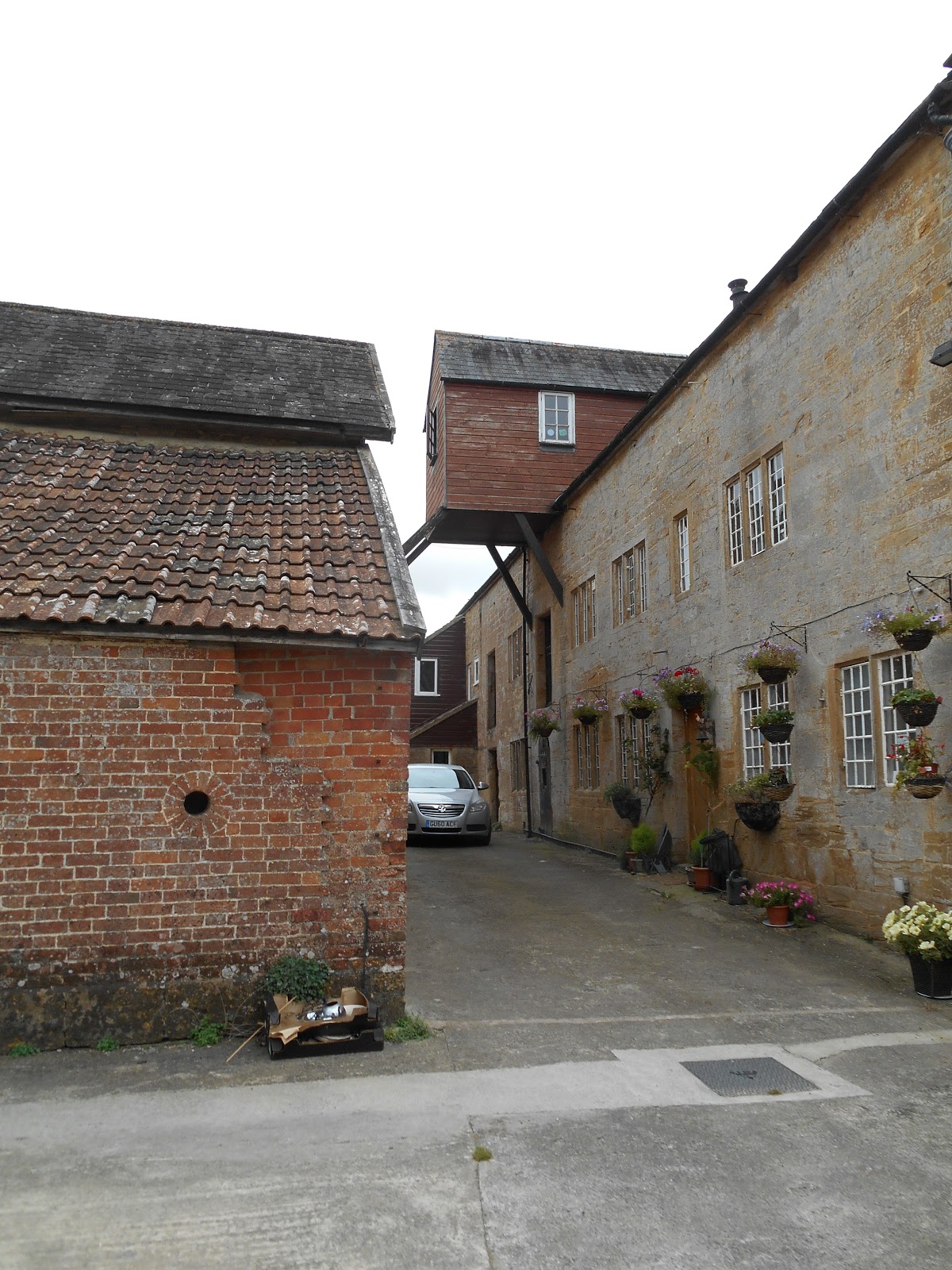
One of the buildings at Gawbridge Mill, which is located on the River Parrett and on the road between Coat and East Lambrook, has a round hole about 4 feet of the ground, which was built into the brick wall when it was originally constructed.  According to the book Curious Somerset by Derek Warren, it is an access hole for cats, so that they could get inside the mill and kill any rats or mice: the rodents were unable to climb up the wall to get in through the hole.  However the current owners of the mill have confirmed that it is in fact a "pay hole" into the pay office.  Mill workers were handed their wages through the hole up until the 1950s.  

The current Gawbridge Mill, which was powered by water from the River Parrett, dates from the 18th century.  It was in use as a mill until the 1960s.

The pay hole is clearly visible from the public road.  I zoomed in with my camera to take the photograph from the road.   Grid reference: ST 443 196

 Pay hole
 Pay hole in context
Gawbridge Mill

Village Signs

Almost all Norfolk villages and many in Suffolk, Essex, Sussex, Kent and Cambridgeshire have signs which depict aspects of the history of the village. The tradition was reputedly started by King Edward VII, who suggested them to encourage village residents to appreciate and take an interest in their villages.  The first signs were erected in the villages on the Sandringham Estate in West Norfolk.  The tradition was continued by Kings George V and VI.  Since then the Queen's Coronation, Silver, Gold and Diamond Jubilees and the millennium have been reasons for many more villages to commission their own signs. Older signs were often carved from wood or made of iron.  Some more modern signs are made from polyurethane, glass reinforced plastic or aluminium.  Most are painted in bright colours.

There are now about 4,000 village signs across the country. However in Somerset interesting village signs are extremely thin on the ground.  These are the only ones I have found so far:

Rode
Rode's village sign is closest in style to those in East Anglia

 Chew Stoke
Chew Stoke is in Bath & North East Somerset

 Long Ashton
Long Ashton is in North Somerset

 Shipham

 Shipham

North Newton's lock gate village sign
The Bridgwater and Taunton Canal runs to the east of the village

West Camel

Norton-sub-Hamdon
 Sign made from local Ham Stone and depicting the village's dovecote

Ash near Martock
This sign is made from local Ham Stone and depicts the parish church.

Milborne Port

Othery's millennium village sign

Some recently replaced council town and village signs now include images of notable local landmarks e.g. the market cross on Cheddar's sign

Brent Knoll - it was also previously known as the Mount of Frogs, hence the frogs on the sign

Stoke St Mary's village sign has a small stained glass window incorporated into it
It was erected to commemorate the Queen's Golden Jubilee in 2002.

Porlock

Cannington

West Monkton 
This has a picture of a heron or an egret and a swingbridge on the Bridgwater and Taunton Canal on it

These are some examples of some typical Norfolk village signs:

Bodham

Little Snoring 

Great Snoring