Sunday, 31 January 2016

Bus Stop Art

In most places bus stops are very dull buildings. However in a few places they have been decorated in imaginative ways.  

These 2 bus stops are located on Coast Road between Berrow and Brean. In 2011 local artist Malcolm Dormer was commissioned by Berrow Parish Council to paint a newly repaired bus stop, which had been partially demolished when a car drove into it in 2010.  The theme he chose was Giraffic Park and features lots of giraffes having a fun day out at the seaside.

Giraffes enjoying a swim in the sea
Giraffes enjoying a day on the beach near Burnham-on-Sea's iconic lighthouse

Giraffic Park

 Bus stop across the road from Giraffic Park.  This one shows the view from the top of Brean Down looking south towards Brent Knoll
  
Cow and fishes in Chiselborough's colourful bus stop

Rising or setting sun at Chiselborough
Presumably these are the names of the painters or maybe designers of the mural?
Underneath the names another one - Joann Bridges - is written and the date 2000

Mosaic on the bus stop at High Street, Aller

Right hand panel of the bus stop mosaic in Aller

Left hand panel of the bus stop mosaic in Aller

Higher Road, Woolavington
This mural was designed and painted by Karon Woodward in 2020.

Higher Road, Woolavington
This bus stop was painted by various members of Woolavington WI, to commemorate the 90th birthday of Queen Elizabeth II.

Brean Bus Stop, 2021

A370, Bristol Road, Congresbury

Kingfisher, Stoke St Gregory

Map of part of North Somerset, Churchill

High Street, Cannington
This bus stop was painted by Emily Kaye in 2024 for the Cannington in Bloom group of volunteers.  It is decorated with flowers, foliage, insects, a church, a tractor and a cat.

Lamyatt
This mural features a monkey, an owl, a sheep, a squirrel, a pheasant and a buzzard.

Church and local wildlife, A38, West Huntspill

Church and local wildlife, A38, West Huntspill

Church and local wildlife, A38, West Huntspill

Cows and chickens, Polsham


Saturday, 23 January 2016

Second World War Balloon Hangar, Pawlett

A huge rusty metal shed a mile to the west of the village of Pawlett at the junction of Gaunts Road with Ham Lane is the most visible reminder of the Royal Aircraft Establishment camp, which was located there in the Second World War.  The shed was a hangar for a barrage balloon and there was a small camp adjacent it to house the people who worked there.  

Pawlett was an outstation of RAE Farnborough.   The site was chosen because it was considered to be at low risk of German air attacks.  The main work carried out at Pawlett was into the testing of German and British barrage balloon cables and methods of cutting them using aircraft. Planes were flown into the cables of the Pawlett balloon from Exeter Airport and later Culmhead Airfield on the top of the Blackdown Hills.  RAE staff working in Exeter were housed in university accommodation and used the physics and chemistry laboratories there.

Barrage balloons were tethered by metal cables and their purpose was to defend strategic locations against attacks by enemy aircraft.  Aircraft were damaged or destroyed when they flew into the cables. The aircraft used in the experiments at Pawlett had various types of strengthened wing edges or cable cutters attached to them. Bomb testing was carried out on Pawlett Hams to the west of the hangar.

The hangar measures 100ft x 70ft x 80ft high and was erected c1940-41.  It was needed so that when balloons were being tested they did not need to be deflated each night. Balloons were filled with a mixture of air and hydrogen made at the gas works in Weston-super-Mare. The experimental work continued until 1944.  Today the balloon hangar stands unloved and rusting away.  You can't get right up to it, so these were the best photographs I could get.

The only other place to have hangars like the one at Pawlett was Sutton Coldfield Maintenance Unit where there were 4 similar hangars.  They have since been demolished.

Grid reference:  ST 284 430


 Balloon Hangar from Gaunts Road

 Front of the hangar

 Front and side of the hangar

Hangar from the opposite side of the River Parrett

Saturday, 2 January 2016

Frank Foley, Righteous Among the Nations, Highbridge

Francis Edward (Frank) Foley (1884–1958) was born on 24th November 1884 at 7 Walrow Terrace, Highbridge. He attended St Joseph's Roman Catholic School in Burnham-on-Sea and Stonyhurst College in Lancashire.  He later studied at St Joseph's College, a Roman Catholic seminary in Poitiers, France. After studying classics at Poitiers University he decided not to become a Catholic priest and in 1908, he began to travel around Europe. When the First World War began he was in Hamburg. He escaped to Britain disguised as a Prussian officer.  He took a commission in the Hertfordshire regiment and was later attached to the North Staffordshire regiment.  After being injured on the Western Front in 1917, Foley moved into military intelligence.

After the First World War Foley was recruited by the British Secret Intelligence Service (later known as MI6) to be their senior spy in Berlin. His cover job was passport control officer and this meant that he was responsible for issuing visas for anyone wanting to go to Britain or elsewhere in the British Empire. He married Katherine Eva Lee (1897–1979) in Dartmouth in 1921. Their daughter Ursula Margaret was born in Berlin in 1922.


When Hitler came to power in 1933 Foley dealt with a huge number of requests from Jews wanting to leave Germany to go to Palestine. He ignored the official rules governing the issuing of visas, thereby ensuring that 1,000s of Jews, who might otherwise have been sent to the death camps, were allowed to travel to Palestine or Britain. He went into the concentration camps such as Sachsenhausen to get Jews out, helped them obtain false papers, visas and passports and hid them in his own home, despite the risk to his own life.

 
Just before the Second World War began Foley left Berlin and was posted to Oslo. From there he co-ordinated the work of British agents in Germany. When Germany invaded Norway in April 1940, Foley was the only link between London and the Norwegian armed forces. He was awarded the knight's cross of St Olav by the King of Norway in 1943. In May 1940 he returned to Britain and was appointed commander in the Order of St Michael and St George for his work in Germany. He was allocated to interrogate Rudolf Hess, Hitler’s deputy, who had flown to Britain on a lone peace mission.


For the rest of the war Foley was in charge of the MI6 contribution to the double cross system: German spies who were caught attempting to gather intelligence on Britain were used to supply false information to the Germans.

Frank Foley retired in 1949 and moved to Stourbridge in Worcestershire.  He died of heart failure at his home, 32 Eveson Road, Norton, Stourbridge on 8th May 1958. He was buried at Stourbridge Borough Cemetery. 

On 25th February 1999, Israel's Holocaust Memorial Centre,Yad Vashem, named Frank Foley Righteous Among the Nations, the highest award the Jewish people can grant to a person who is not Jewish. 

In 2005 a statue of Frank Foley designed by Jonathan Sells was unveiled in Market Street, Highbridge. It was paid for by public fundraising.  A road in Burnham-on-Sea has also been named after him (The Frank Foley Parkway) and there is a plaque on the house where he was born.  A bronze plaque detailing his achievements was unveiled on Highbridge's war memorial in Southwell Gardens in 2000.  The bronze plaque was stolen in 2011 but replaced with a granite one in 2012.

There are also plaques honouring Frank Foley at the entrance to Mary Stevens Park in Stourbridge and at the Sternberg Centre in Finchley. 

Frank Foley is still regarded as one of the most successful agents ever recruited by MI6.  It is believed that he saved the lives of about 10,000 people, although many of them were not aware of his identity.

 The Frank Foley Parkway, Burnham-on-Sea

 Frank Foley Statue, Highbridge

Frank Foley Statue, Highbridge
 - the detail continues around the back


 War Memorial in Southwell Gardens at Highbridge.  
The original bronze plaque was stolen in 2011.  You can see the light area on the stone table where it was affixed.  It has been replaced by a granite plaque at the front of the war memorial.  However the war memorial garden was locked up when I visited in March 2016, so I couldn't get any closer.

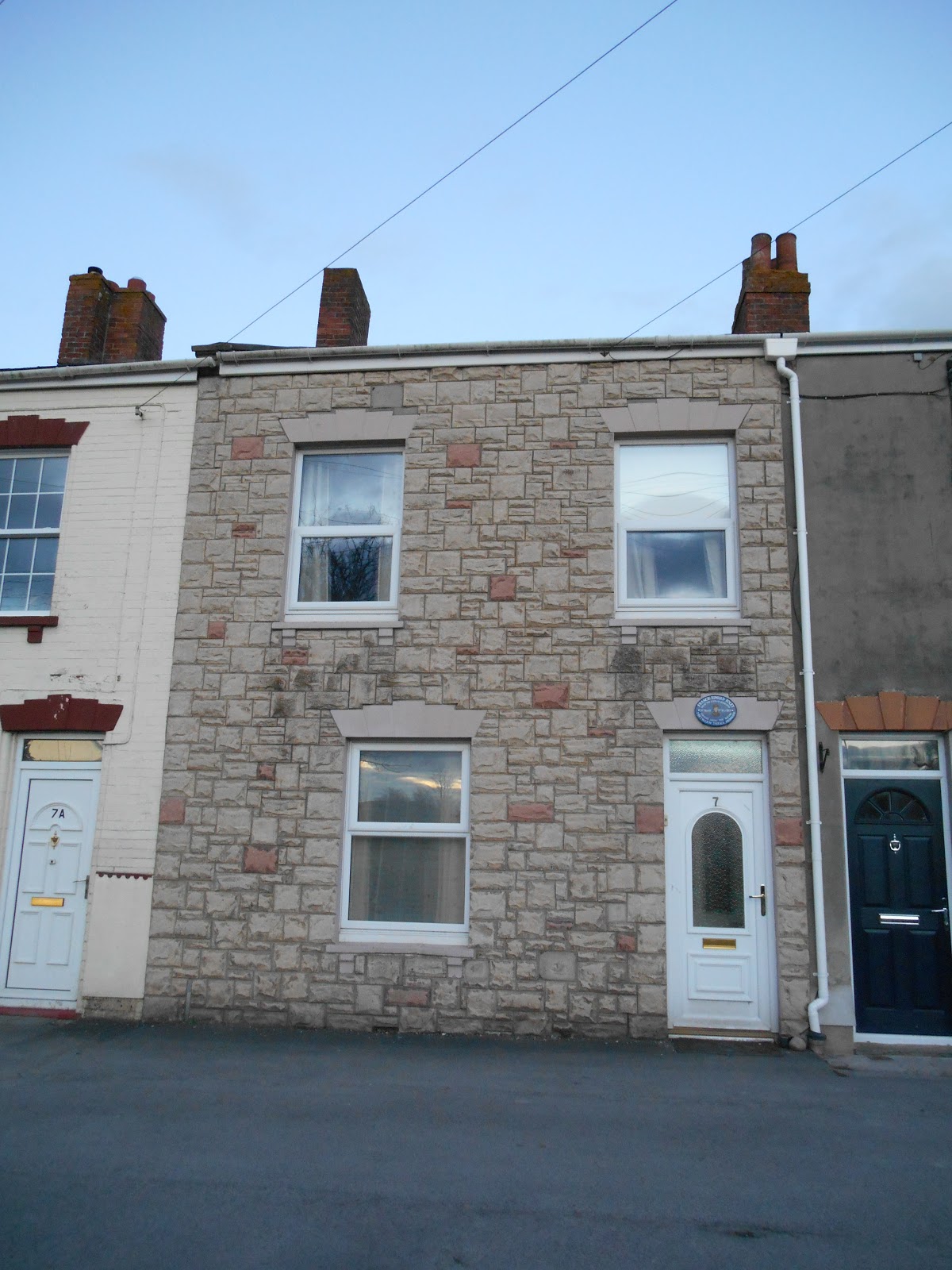
7 Walrow Terrace, Highbridge, where Frank Foley was born.  
A commemorative plaque is displayed above the front door.

Plaque above the door of 7 Walrow Terrace, Highbridge

Further Reading:

Foley: the spy who saved 10,000 Jews by Michael Smith. Published by Hodder in 1999.

Joseph of Arimathea and Paradise, Burnham-on-Sea

According to legend, Joseph of Arimathea landed on the beach at a spot between what is now Burnham-on-Sea and Berrow on his way to Glastonbury.  He is said to have named the place where he landed Paradise. A metal plaque commemorating this event was originally located on the wall of the Horlicks/Paradise Dairy.  The dairy was demolished in 1990 and in March 2000 the plaque was re-erected on the back of a garage wall in a small garden with a bench on the corner of Shelley Drive and Berrow Road.  It was unveiled by Councillor Peter Clayton, who was the Deputy Mayor of Burnham-on-Sea at the time.

Joseph of Arimathea is mentioned in all four gospels in the New Testament.  He was a disciple of Jesus and asked Pilate for permission to bury Jesus's body after his crucifixion.  He also donated the rock tomb where Jesus's body lay for 3 days until his resurrection.  According to legend Joseph was a metal merchant and visited England to buy tin from Cornwall and lead from Somerset.  He is said to have been Jesus's great uncle and to have founded a church at Glastonbury.  He is also said to have brought Jesus with him to England when Jesus was a child.  He is also associated with the legend of the Holy Grail and the original Holy Thorn tree is reputed to have grown from his staff, which he planted in the ground at Glastonbury.

 Paradise Dairy Plaque on Berrow Road

Small garden with plaque

When I visited in December 2015 the garden looked in need of a bit of TLC and not much like how I imagine paradise to be!

Friday, 18 December 2015

Christmas Lights, Trinity Close, Burnham-on-Sea

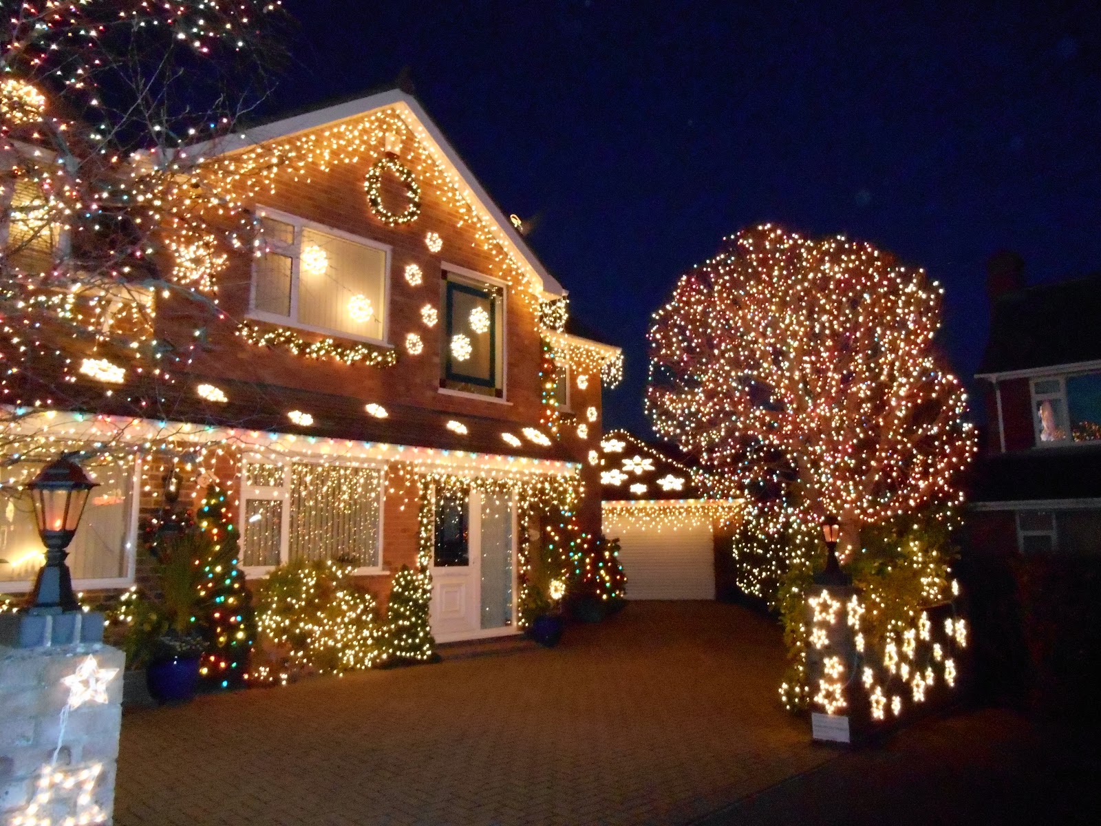
Trinity Close is a small cul-de-sac in Burnham-on-Sea.  Unremarkable for 11 months of the year, for the whole of the month of December it is lit up.  The tradition was started by Nick and Hazel Gardner in 2001. The aim is to raise money for local charities and over the years more than £60,000 has been raised.  The homes in the close are decorated with over 100,000 lights.  When I visited in December 2014 only one of the houses in the close had no lights at all. 

The photos below were taken in December 2014.

Trinity Close

Trinity Close

A winter wonderland

 The most colourful house

Santa and three of his reindeer

 Beautiful tree

Thursday, 3 December 2015

Ashwick Grove House, Oakhill

Ashwick Grove House is a shadow of its former self.  In the late 18th century an existing house was altered and enlarged for the agricultural improver John Billingsley (1747-1811).  His family had lived there since the 1690s.  At the rear of the house there was a row of buildings, which were cut into the rockface and possibly used as cold stores.  The main entrance to the house was along a tree lined avenue from the south.  There was a lodge house on what is now Fosse Road.  The Fosse Way runs roughly parallel to the avenue and no more than a couple of hundred metres to the east of it. The house stood in a landscaped park and had a formal garden adjacent to the east side of the house and a wilderness garden to the east of the formal garden.  The wilderness garden blended into Home Wood.  There was a rustic stone grotto set high on the steep slopes of Home Wood.   The grotto is apparently still there, although very overgrown.

After John Billingley's death in 1811 the house stood empty for some years before being bought by the Strachey family who lived there from c1830 until 1937.  The estate then had to be sold to pay death duties.  Presumably there were no buyers for the house, as it was partially demolished in 1955 with some of the architectural features being salvaged and sold at auction.

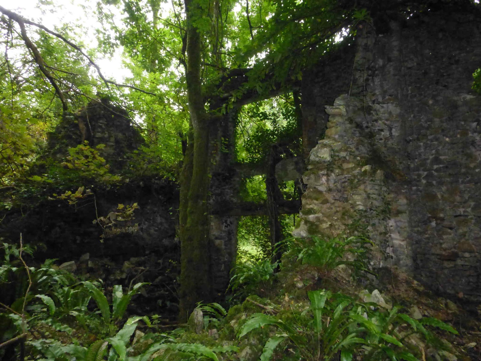
Since then nature has reclaimed the site and now trees grow where there were once grand rooms.  Sometime after 2000 the last remaining part of the front elevation collapsed into a heap of rubble.  The house is still rather optimistically marked on the 1:25,000 scale Ordnance Survey map.

An avenue of yew trees is still growing as you approach along a path from the east.  However other trees have now grown up around them.  The former stable block and coach house, which lie to the west of the main house, have been converted into houses. 

My thanks to Sue for taking the photos below for me.

Further Reading: Ashwick: Coal, Ale and Pasture - edited by Penny Stokes.  Published by Mendip District Council, 2002. 

Ferns are thriving in the ruins

 One of the few remaining walls still standing

 The remains of a garden wall?

 A jungle reclaims the house

Tuesday, 1 December 2015

The Dwarf's House, Bawdrip

The Dwarf's House is located on Church Road in Bawdrip. There is very little written about it and no one seems to know why it is so small - its external measurements are 13 feet long by 9 feet wide and 13 feet high.  It has 2 floors and the front door is only 4 feet 10 inches high.  It is no longer used as a house.  Grid Reference ST 342 395.

 Dwarf's House, Bawdrip

Village Animal Pounds

Animal pounds were secure enclosed areas where trespassing animals (usually cattle, horses, pigs or sheep) were impounded until their owners paid a fine or they were released as a result of a court judgment.    Most medieval villages had an animal pound. The man in charge of impounding the stray animals was paid by the Lord of the Manor and was known as a pinder or pounder.  Fines and disputes are documented in manorial court records.

In the medieval period the field system in use was an open one, so it would have been easy for animals to stray onto a neighbour's land.  Animals grazing unlawfully on common land could also be impounded.  If a person owed a debt to another person, their animals might also be impounded until the debt was paid. 

The word pound comes from the Old English word pund, meaning a pen or enclosure.  In parts of Scotland e.g. Shetland the word pund is still used.   The term pinfold is used in some parts of Britain instead of pound e.g. in the north and east of England.

Pounds were often sited near village greens, churches or crossroads to enable local residents to check if any of the impounded animals belonged to them. They were used up until farmland was enclosed in the 17th to 19th centuries.   

In some places the pounds were probably enclosed by hedges or wooden hurdles/rails and these have long since disappeared.  Some places had brick or stone animal pounds and a few of these have survived.  However some of the surviving pounds have at a later date been incorporated into neighbouring properties and so are no longer recognisable as animal pounds.

Not many examples of animal pounds survive in Somerset. The ones I am aware of are at Holford (dog pound), Crowcombe, Oakhill, Brompton Regis, Chaffcombe and Stogursey.  There is also one in North Somerset at Hutton.

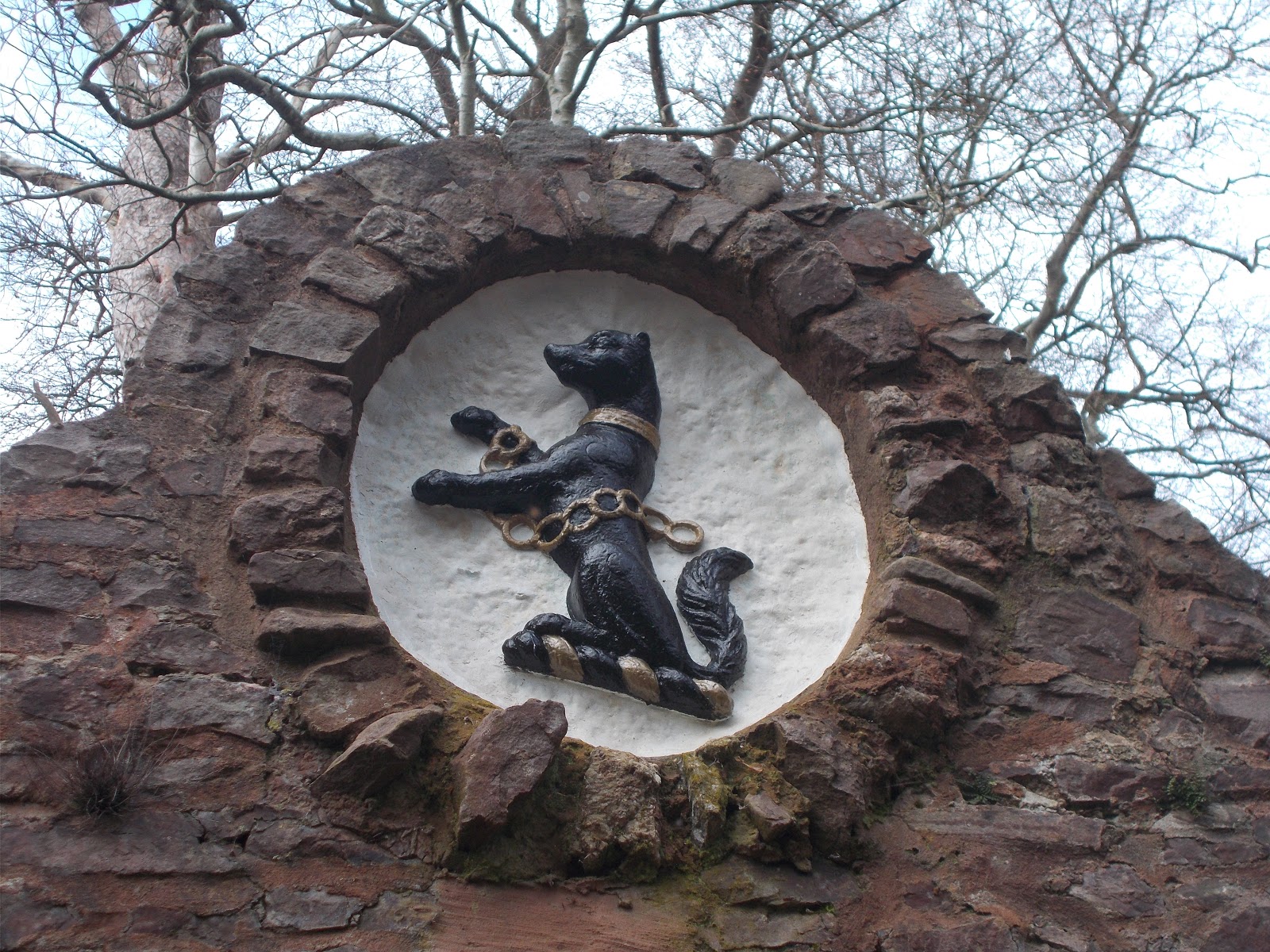
The (possibly apocryphal) story behind the Holford Dog Pound is that at some unspecfiied time in the past the pack of hounds used in hunts were kept on the Alfoxton estate.  Meat which would be used to feed them, was stored hung high in trees out of their reach until it was needed.  However the meat attracted local stray dogs.  One night the hounds were disturbed by the local strays and the huntsman who normally looked after the dogs went out to see what the matter was.  However he did not put on the clothes he normally wore to do this.  This meant that the hounds did not recognise him and they attacked and killed him.  The dog pound was built, so that local stray dogs could be rounded up and incarcerated, so that they wouldn't disturb the hounds.  The plaque below the dog crest reads: "This ancient dog pound was given to the village of Holford in 1982 by the family of the late John Lancelot Brereton, descendants of the St Albyns, owners of Alfoxton since the 15th century, whose crest appears above."

Crowcombe has had an animal pound since at least 1642 when it was first mentioned in official records.  It was used up until the 1920s or 1930s.  It was restored in 2004 by Crowcombe Women's Institute.  The large fern growing inside it is at least 60 years old.

 Dog pound at Holford

Recently repainted Brereton family crest on the Holford Dog Pound - December 2019

Entrance to the animal pound at Crowcombe

 Captive fern in Crowcombe Pound!

 Oakhill - the pound has been converted into a lovely garden

 Oakhill Animal Pound

 Plaque on Oakhill Pound


 I think this is the remains of the animal pound at Brompton Regis.  It is located behind the village lock up 
 Brompton Regis - lock ups for humans and animals

Entrance to Stogursey's animal pound
 - a dog waits patiently to be claimed by his owner. 

 Stogursey's Animal Pound
The pound is located on the corner of Castle Street and St Andrew's Road. There is a small garden inside it but it was locked on the day I visited in December 2015.
 
Chaffcombe
The pound here has been turned into a community garden with a strange colourful sculpture in the middle of it, a bench and some apple trees

Pound Cottage, Chaffcombe
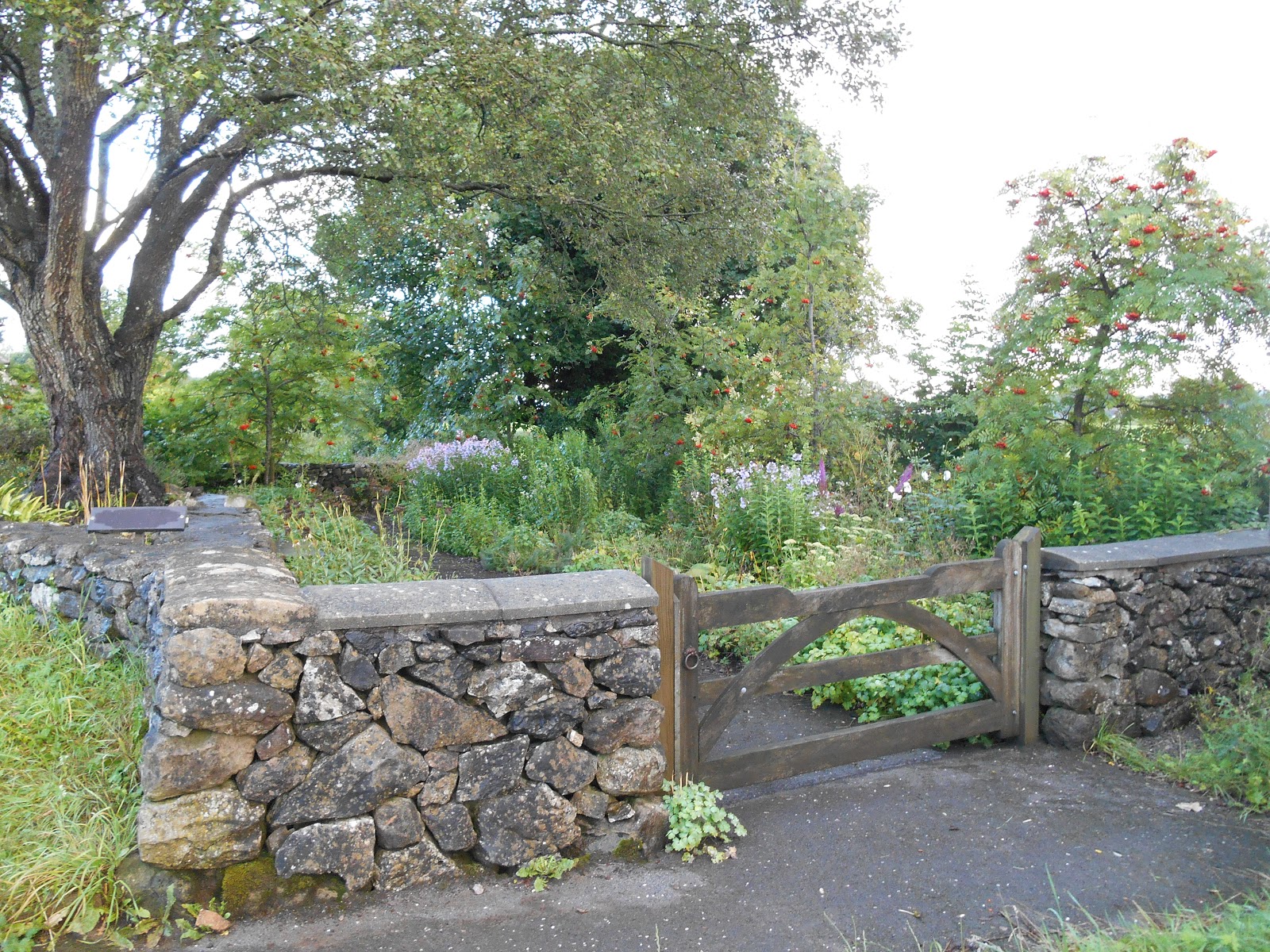
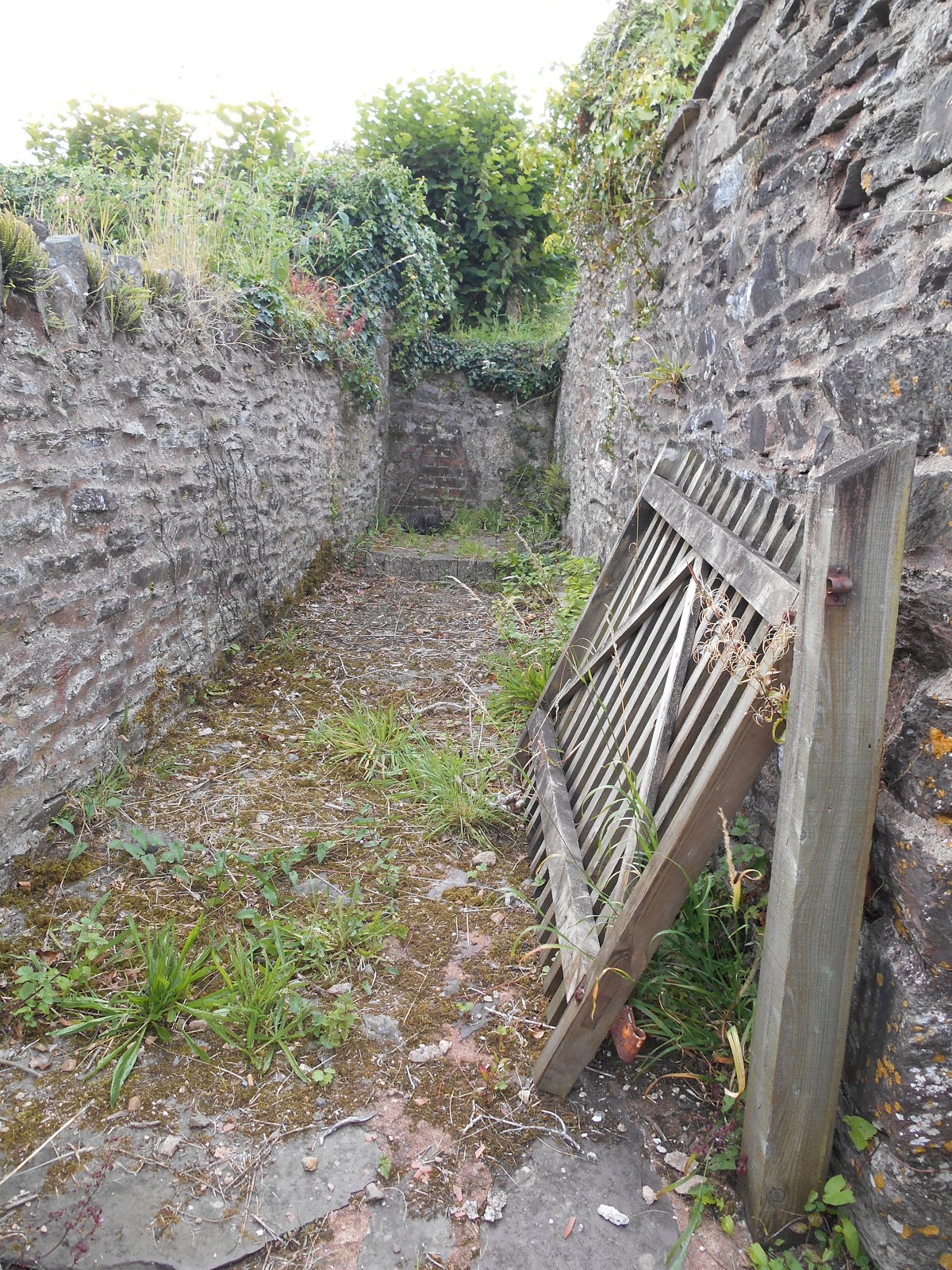
 The overgrown wall in the foreground was part of the village's animal pound.

Pound in Great Elm Road, Mells

Hutton Parish Pound

Hutton's Parish Pound

Stone and plaque (placed there in 2000) at the site of Lympsham's village pound and Manor Farm.

West Bagborough's pound
This was restored in 2000

Burrington
This pound on Fry's Lane dates from 1838-1888