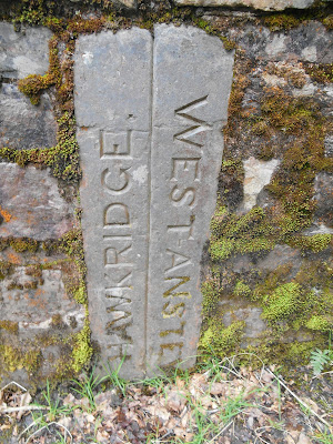
Boundary Markers are usually made of stone, concrete or metal, so that they are durable. People have been marking borders for centuries, if not millennia. Some of Somerset's boundary stones are so old that no one knows for certain, which boundary they were originally supposed to mark.
Taunton Town Council Boundary Marker
CBB = County Bridge Boundary, Washbattle Bridge near Huish Champflower
This stone may be prehistoric or medieval and its purpose was to mark the boundary between Brompton Regis and Old Cleeve parishes
Hundred Stone, Yeovil
This stone marks the meeting place for men of the local hundred and is thought to date back to the medieval period. It was last used as a meeting place in 1843.
Longstone, Quantock Hills
AX = Axbridge
Blue Plaque marking Chard Borough Boundary
Taunton Trust turnpike boundary marker on the Brendon Hills
This marks the boundary between Brockley and Chelvey Parishes
Beacon Hill
This boundary stone has the letters WMFM inscribed on it. These are thought to be the initial of William Melliar Foster Melliar, who bought part of the wood in Doulting Parish in 1883.Bicknoller Post, Quantock Hills
Unusually, this boundary marker is made of wood. It is located at the point where 3 parishes meet: East Quantoxhead, West Quantoxhead and Bicknoller
This wooden post marks the boundary of the Carnarvon Estate. It is located between Withypool Hill and Halscombe Allotment (grid reference SS 828 334). A post was first erected here in 1796. This replacement post dates from 2002 and was erected to commemorate the Queen's Golden Jubilee and in memory of Lord Porchester, Earl of Carnarvon, the Chairman of the 1977 inquiry into the protection of moorland on Exmoor.
Brushford/Dulverton Parish Boundary Stone at New Bridge, Brushford
This is probably a 19th century boundary stone for Venford Farm. The word Venford is inscribed on the east face.
Sloley Stone, near Mole's Chamber, Exmoor
The Sloley Stone marks the boundary between Somerset and Devon and the boundary of Exmoor Forest. It has previously been called the Long Stone, Hore Stone and Lew Combe Stone. The south east face (shown here) is inscribed with the words William Longe Oxenham Esquire Lord of ye Manor of High Bray, 1742. The north west face is inscribed with the words Christian Slowly, Lady of the Manor of Gratton, 1742. The stone is 1.34 metres high and 0.56 metres wide.
This 1.7m high stone marks the border between Somerset and Devon and also the former boundary of Exmoor Forest. It is by the side of the B3358 between Challacombe and Simonsbath (grid reference SS719407) but there is nowhere to park a car, so we took the photo from the car window. It was called Longstone in a survey of 1651 but by 1675 it was called the Edgerley Stone. The names F. Bray and F. Isaac are inscribed on it.
W = Weacombe
This boundary stone on the Quantock Hills between Bicknoller Combe and Weacombe Combe marks the boundary between the St Audries (St A) and Weacombe (W) estates. It was erected after Thomas Cridland Luxton purchased Weacombe Farm and 69 acres of common land in 1836. It is made of local red sandstone.
St A = St Audries
1912 boundary stone between the City of Bath and Somerset County Council
Sadly this boundary stone, which is located at the side of the A367 at Odd Down on the edge of Bath, has been half buried in concrete!
Boundary marker outside 50 Middleway, Taunton
These two shields are made from Ham stone. One has St Mary's inscribed on it and the other Glebe. The house is on land, which belonged to Henry Bower, Vicar of St Mary Magdalene's Church in the early 19th century, and which may have been glebe land.


No comments:
Post a Comment