Showing posts with label Lighthouse. Show all posts

Friday, 2 September 2022

Battery Point Lighthouse, Portishead

Battery Point Lighthouse was built in 1931 by Chance Brothers of Smethwick on a rocky promontory on the north west edge of Portishead.  The deep water channel known as King Road passes very close to the coast at this point.  The lighthouse, which is also known as Portishead Point Lighthouse, is nine metres tall and consists of a black metal pyramid on a square concrete base.  The lighthouse is maintained by Bristol Port Company.  In 1999 they announced that they wanted to demolish the lighthouse and replace it with a modern navigational aid.  After a campaign by local residents, they agreed to build a replica of the original lighthouse.

Battery Point Lighthouse

Container ship passing Battery Point Lighthouse

Battery Point Lighthouse

A two tonne bronze fog signal bell was installed at Battery Point Lighthouse in 1939.  It was removed c1998.  It was found in a warehouse owned by Bristol Port Company in Avonmouth in 2010.  After a campaign by local residents, it was acquired by Portishead Town Council in 2012.  It was restored and re-sited on Wyndham Way in 2013.

Battery Point Bell on Wyndham Way

There is a Merchant Navy Memorial close to Battery Point Lighthouse with a brass plaque attached to it.  The words on the plaque are as follows:

“This stone is situated here at Battery Point, the closest place on the coast of the United Kingdom which large ships pass.

It is dedicated to seafarers of the West Country who, since the Middle Ages, on voyages of discovery and in times of peace and war, have passed this point, some never to return.

“Oh hear us when we cry to thee, for those in peril on the sea.”

Erected by the Merchant Navy Association North Somerset Branch, 2005”

Merchant Navy Memorial at Battery Point

Thursday, 17 March 2022

Black Nore Lighthouse

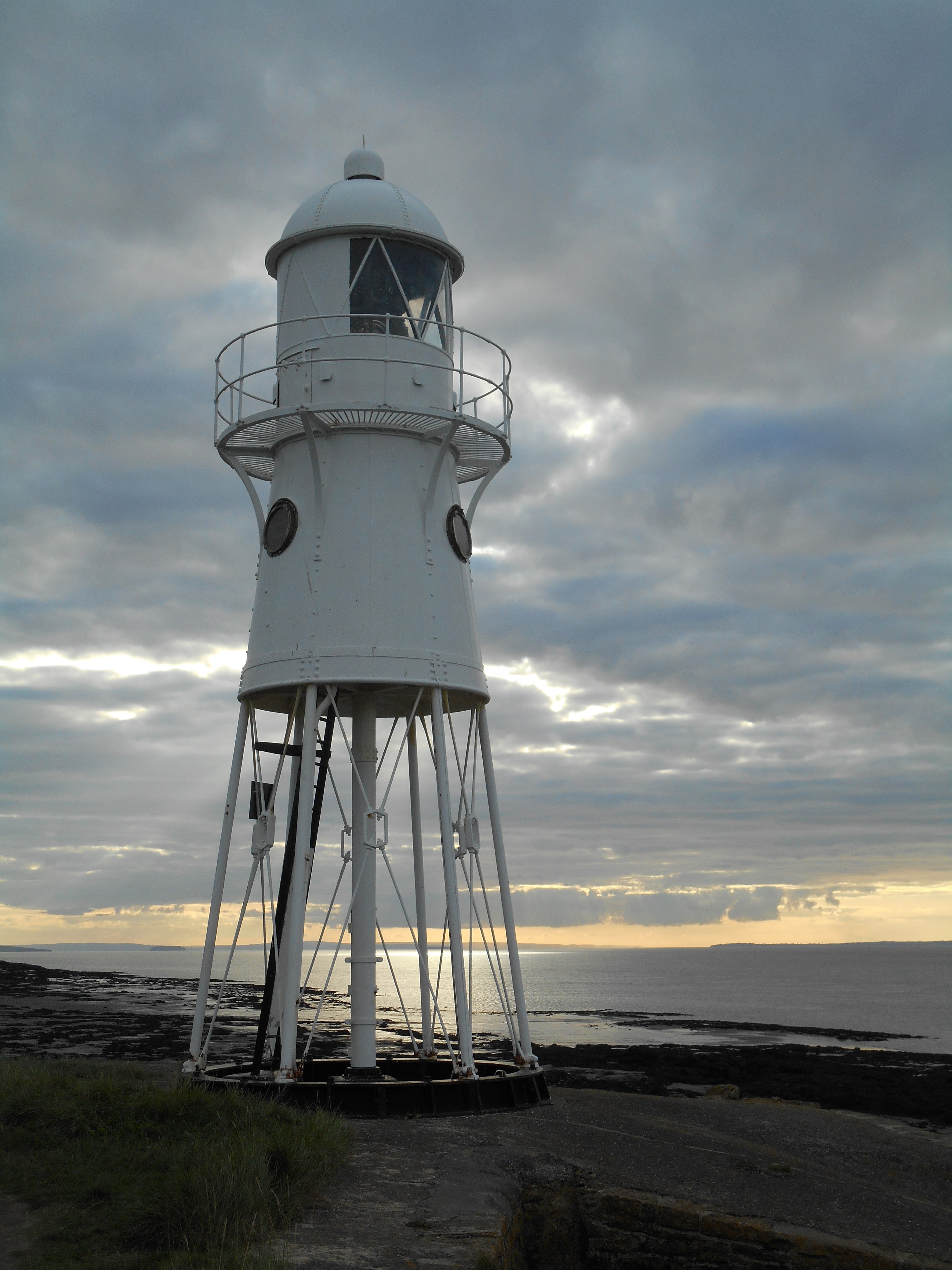
Black Nore Lighthouse was built on a coastal outcrop at Portishead by Trinity House in 1894.  Its purpose was to be a navigation aid for shipping heading for the port of Avonmouth or the River Avon.  There is no vehicular access to it – the lighthouse can only be accessed via the coastal footpath.   Links to the coastal footpath at Black Nore are available at the junction of Glenwood Rise & Nore Road and at the northern end of the cul-de-sac called Pinecroft.  

Despite its name, the lighthouse is painted white.  It is made of riveted cast iron, has six legs and is 11 metres high. The outcrop on which it was constructed, was built up with masonry to form a platform. There is a ladder underneath it, which leads up to an entrance hatch. Its lamp was originally powered by gas.  The mechanism had to be wound every day and this task was undertaken by members of the Ashford family, who lived nearby at Black Nore Farm.  The light was converted to electricity and automated in 1941, so that it could be switched off during air raids.  The winding and drive mechanisms were replaced by an electric motor in 2000. 

The lighthouse was decommissioned by Trinity House on 27th September 2010 and the internal mechanism was removed.  It was sold to a community interest company in October 2011 for £1. They have pledged to keep it as a monument on the coast for everyone to enjoy.  It has been a grade II listed building since June 2011.

Black Nore Lighthouse

Black Nore Lighthouse

The TH stands for Trinity House – this stone is located adjacent to the lighthouse

Black Nore Lighthouse

Thursday, 3 November 2016

Burnham-on-Sea's Three Lighthouses

Burnham-on-Sea has had three lighthouses in the past. 

The story goes that c1750 the wife of a Burnham fisherman placed a candle in a window to guide her husband home.  After the death of her husband in a boating accident she continued to do this and was later paid to do so.  After her death a light was placed on top of the tower of St Andrew's Church with the permission of the Curate, the Reverend David Davies.  He offered to build a lighthouse if the local fishermen would pay for its upkeep.  The 4 storey Round Tower Lighthouse was built attached to his house and adjacent to the churchyard in around 1800.  In 1813 Rev Davies successfully applied to Trinity House for a grant and permission to levy dues on passing ships.  He was granted a lease for 100 years but Trinity House purchased it back from him in 1829.

In 1832 Trinity House built the High Lighthouse on the landward side of the sand dunes on Berrow Road.  At the same time the height of the original lighthouse was reduced by 2 storeys and a parapet was added to avoid confusion with the new lighthouse.  The High Lighthouse was built of brick and is 30 metres high. It is known locally as the Pillar Lighthouse.

However it was soon realised that the light was too low to be seen at certain states of the tide (the Bristol Channel has the second highest tidal range in the world).  Therefore the Low Lighthouse was built on the beach due west of the High Lighthouse to complement it in 1834.  It was constructed of teak on legs of oak to raise it above the level of the high tide.

The High Lighthouse was decommissioned in 1969 and sold off as a private dwelling, although the red vertical stripe painted down the seaward side of the tower still acts as a daymark.  The Low Lighthouse was decommissioned at the same time but was brought back into use as a navigation light in 1993.

Burnham's First Lighthouse from St Andrew's Churchyard

Burnham's High Lighthouse
 
Red Stripe on Burnham's High Lighthouse

Back of Burnham's Low Lighthouse

Burnham's Low Lighthouse from the back

Front of the Low Lighthouse at low tide

Low Lighthouse on the Beach

Low Lighthouse