Monday, 15 April 2024

Minehead's Maritime Heritage Plaques

In 2014, as part of the Minehead Maritime Heritage Project, seven plaques were created and mounted on the harbour wall. They were unveiled by the Les Smith, the Mayor of Minehead on 11th July 2014 at the Minehead Harbour Festival.  The plaques depict the seven eras of maritime heritage in Quay Town, Minehead and the vessels, which would have been in use at the time.

A series of workshops and projects, lead by Halsway Manor with sea shanty specialists Tom & Barbara Brown and storyteller Alex Simson, were held with local residents and schoolchildren to create the artistic brief.    The plaques were then designed and made by artist Sue Webber and author John Gilman.  Sue made 3-dimensional clay panels, which were then cast in resin and bronze powder by local company S&S Exmoor.  

The First Millennium and the Currach
The Celts sailed in light but durable currachs.  These were made of hide and wicker, could be up to 60 feet long and were capable of long voyages across oceans. This scene shows a saint looking for somewhere to live his life in prayer, solitude and learning.  He chose the spot where St Michael's Church now stands.

The 1100s - The Cog and the Carrack
The scene on this plaque is the raiding party of Welsh pirates led by William de Berkley, which arrived off the coast of Minehead on 1st August 1265.  They were defeated and William de Berkley and his crew were captured by Adam Le Gurdon, who was the master of Dunster Castle garrison.  They were executed by public drowning in Minehead Harbour. Cogs were oak planked boats with a single square sail.  They developed from the currachs.  Portuguese and Spanish boatbuilders later developed the carrack, which had 4 sails and fortified forecastles and aftercastles at the bow and stern. 

The 1500s - The Galleon
Galleons evolved from the carracks and were common by the 1500s.  They were fully rigged and had deeper keels that the carracks.  This meant they were capable of long sea voyages but couldn't be sailed in shallow inland waters.

The 1700s - Tops'l Schooner
Ships paid to shelter in Minehead Harbour .  A new harbour was built in Minehead.  Fees were levied to pay for the new harbour and for the removal of silt and shingle from the harbour mouth, as the former save haven located where Blenheim Gardens now are, had silted up completely. 
                                                                                                                 
The 1800s - Fully Rigged Ships
This plaque shows Minehead Harbour when it was at its busiest, with lots of herring boats.  Supporting industries e.g. ropemaking, sail making, chandlers and carpentry were located nearby.  Towards the end of the 19th century the herring were overfished and the catches declined as a result.

First World War - Steamers
Minehead is decorated with bunting and fairy lights during a July Gala Week when Battlecruiser HMS Furious and Destroyer HMS Vega were anchored offshore. On the Saturday night 3,000 people watched a light show.  A pier opened in 1901 and this allowed steamers to dock in Minehead.  The herring industry was in decline and Minehead was reinventing itself as a holiday resort.

Second World War - Lifeboats and Convoys
John Slade and Tom Escott are shown in the lifeboat Mouette.  They sailed to Blue Anchor Bay to examine a partially submerged object, which had been spotted.  It turned out to be a mine, which exploded as they approached it and they were both killed.  A minesweeper can be seen in the distance and Spitfires are shown in the sky.  A gasometer stands next to the lifeboat house.

Tuesday, 2 April 2024

Ice Houses

An ice house is a building used to store ice all year round. Ice was transported from lakes, ponds and rivers in winter by wheelbarrows or small carts.  It was packed into the ice house and then stamped on to form a solid mass. Sometimes salt was added to aid the freezing process.  When ice is packed together into a large mass, the relatively small surface area slows down rate of thawing.  It was then covered with a layer of straw to insulate it.  The ice would stay frozen for up to two years. Sometimes foods such as meat, fish, butter and fruit were stored in the icehouse.  

The most popular location for ice houses was the bank of a stream or pond and not too far from an estate road.  Almost all icehouses on country estates have an entrance, a passage, a vault and a drain (for meltwater, in the base of the vault). Most ice houses had roofs of either earth or thatch. Some ice houses had a chute in the roof above the centre of the vault to allow ice to be unloaded from above. Only a few ice houses were designed to be landscape features in the gardens of country houses.

Ice was stored in icehouses for use in the kitchens and dining rooms of stately homes. When ice was needed it was chipped out and taken to the house.  It was washed and placed in wine coolers and ice buckets to cool drinks and make iced desserts.  Fruit, fish and game were also laid on beds of ice to keep them fresh.

One of the first recorded ice houses in Britain was built in Greenwich, London in 1619. The idea for ice houses probably originated in France and Italy.  About 3,000 ice houses were eventually built in Britain and by the mid 19th century most country houses had at least one.  The majority of ice houses were built between 1750 and 1875. They were also built for commercial use, e.g. for packing and transporting fish or meat, for the manufacture of ice cream or for the sale of ice for domestic use.

From the 1840s crystal clear ice was imported into Britain from the USA, especially from Wenham Lake near Boston in Massachusetts, and later from Norway.  Ice houses continued to be used until the late 19th century when ice making machines and refrigerators became available.

There are very few icehouses in Somerset which are accessible to the public.  Montacute and Prior Park, which are both owned by the National Trust, have ice houses.  You can see the mound of the East Coker icehouse from a public footpath that runs close by. Nynehead Court has a very large ice house and the gardens are open to the public on certain days of the week but you need to book your visit in advance. There is an icehouse in a wood on the Ashton Court estate.

Montacute icehouse was built in the late 18th or early 19th century.  It has a Latin inscription over the door: "in superet Glacies frondeat atque Nives", which means "freshness springs from the ice and snow." It is situated halfway between the kitchens and the ponds in the park.

Entrance to Montacute Ice House

Looking down in to Montacute Ice House

Entrance to Montacute Ice House from inside

Diagram showing a cross-section of Montacute Ice House


Cut-away diagram of Montacute Ice House

East Coker Ice House

Entrance to Nynehead Court Ice House

Nynehead Court Ice House

The ice house at Nynehead Court was built in 1803.  It is made of brick and has an iron drain cover at the base.  There appears to have once been an entrance on the north side, but the current entrance way is on the south side.  It would probably have had 2 or 3 doors originally to act as insulation between the warmer air outside and the cool air inside the ice house, but it currently has none.  The ice house was filled with rubbish at some point after the 1950s, but it was emptied out and restored in 1995 by Taunton Deane Borough Council.

Prior Park, Bath
The Prior Park ice house is located half a mile downhill from the mansion it served, but close to the lakes, from which the ice was collected.  It was built c1755-60 for Ralph Allen.  He had the park laid out 1734-1740 and the mansion was built for him 1733-1750.  The external walls were made using Bath stone and the inside was lined with red bricks. During the Second World War it was used as a base by a top secret auxiliary unit of men, who would have led the resistance in the event of a German invasion. They made changes to the ice house, including digging an escape tunnel, which was accessed via a trap door and a wooden ladder. They also inserted timber beams into the internal walls of the chamber, so that they could create a second storey.

Further reading: 
Icehouses: Tim Buxbaum, Shire Publications, 1988

Friday, 15 March 2024

Rachel Reckitt, Artist and Sculptor

Rachel Reckitt was born in St Albans in 1908.  Her father, (Frank) Norman Reckitt was an architect and her mother Beatrice (nee Hewett) had studied fine art at the Slade School of Art.  She had two siblings: Vera and Basil.  In 1923 the Reckitt family moved from Hertfordshire to Golsoncott near Roadwater.  Norman Reckitt designed an Arts & Crafts style village hall for Roadwater in 1928.

Rachel studied at the Taunton School of Art in 1926 and then in 1933 she moved to London to study at the Grosvenor School of Modern Art where she was taught by the Scottish artist Iain Macnab.  She exhibited with the Society of Wood Engravers from 1933 but then turned to painting and sculpture.

In 1937 Rachel made the first of 5 sculptured signs for Somerset pubs out of metal sheeting.  Over the next 2 years she made signs for the Valiant Soldier at Roadwater, the White Horse Inn at Cleeve, the Butchers Arms in Carhampton, the Blackbird on the A38 near West Buckland and the Halfway House at Willand.  

Rachel Reckitt returned to live in London in late 1939. She studied at the Hammersmith School of Building Crafts from 1940 to 1945 and also studied lithography at the Central School of Art and Design. In the late 1940s she was commissioned to produce the illustrations for several books.

In the late 1960s Rachel began to learn the craft of blacksmithing and welding with Harry and Jim Horrobin at Roadwater Forge.  In 1974 she and Jim Horrobin were commissioned to make a tower screen for St Andrew's Church, Old Cleeve.  Four fibre-glass panels were painted with the patron saints of the churches in the same benefice.  Three large angels are arranged above the screen.

Examples of Rachel's work can be found in all the other parish churches around Golsoncott:

  • Jacob wrestling with the Angel (1972), wooden carved angel (1961) and candelabra at St Bartholomew's Church Rodhuish
  • Praying Figure carved from elm, St John's Church, Carhampton
  • Reredos, capitals and pulpit decorated with passion flowers and foliage; portrait of St Giles; candelabra at Leighland Chapel
  • Statue of St Nicholas in Withycombe

Rachel Reckitt regularly travelled around Europe with friends and family before and after the Second World War, in search of inspiration for her work.  

Rachel died in 1995.  After her death the proceeds of her estate were used to establish a charitable trust called the Golsoncott Foundation.  Rachel was the aunt of the author Penelope Lively.

Praying Figure, Church of St John the Baptist, Carhampton

Tower screen, St Andrew's Church, Old Cleeve

St Nicholas, Withycombe

Butchers Arms, Carhampton

Butchers Arms Pub Sign, Carhampton

Pulpit, Leighland Chapel

Close up of the decoration on the pulpit

Chancel capital, Leighland Chapel

Candelabra, altar and reredos, Leighland Chapel

Candelabra decorated with flying swans or geese, Leighland Chapel

Reredos, Leighland Chapel

Portrait of St Giles, Leighland Chapel

Valiant Soldier pub sign, Roadwater


Jacob wrestling with the Angel, St Bartholomew's Church, Rodhuish

Candelabra by Rachel Reckitt and Jim Horrobin,
St Bartholomew's Church, Rodhuish

Carved angel, St Bartholomew's Church, Rodhuish

St Bartholomew's Church, Rodhuish

The Blackbird pub sign

The Farm or House in Catalonia
This was painted by Rachel Reckitt in the 1930s.  The painting now belongs to Salford Museum & Art Gallery.

Roadwater Village Hall
There is a stone plaque next to the entrance door, which says that it was laid by Mrs Norman Reckitt on May 24th 1928

Friday, 1 March 2024

Larkbarrow Farm

John Knight built Larkbarrow Farm as a model farm in the 1840s.  He attempted to turn large areas of moorland on Exmoor into productive farmland.  The farmhouse and outbuildings were arranged around a courtyard.  Trees were planted on three sides of the farm to shelter it.  The first tenant was James Meadows.  He arrived in 1852 but he left by 1852 when his attempt to establish a dairy farm and produce cheese failed.  Larkbarrow was uninhabited until the 1860s when shepherds from Scotland lived in the farmhouse.  It was later used as a shooting lodge.  The farm passed to the Fortescue Estates in the late 19th century.  

During the Second World War the farmhouse was used for target practice by the army and only a few low walls remain standing today. The site has been conserved by Exmoor National Park Authority: they have capped the standing walls and cleared the undergrowth.

Another model farm was constructed c1850 half a mile to the west of Larkbarrow Farm, at Great Tom's Hill. This farm was occupied until the Second World War, when it too was used for target practice.

Larkbarrow Cottage was built between Tom's Hill Farm and Larkbarrow and was occupied until the 1920s.  In July 1923 one of the occupants, Will Little, was killed when he was struck by lightning on his way back from work at nearby Warren Farm.  The remains of Larkbarrow Cottage can still be seen.

Since 2021 Larkbarrow Farm has been used as the destination for the Exmoor Dark Sky Discovery Trail. 

Larkbarrow Ruins

Larkbarrow Ruins

Larkbarrow Ruins

Larkbarrow Ruins

Larkbarrow Ruins

Larkbarrow Ruins

Exmoor Dark Sky Discovery Trail post at Larkbarrow

Exmoor Dark Sky Discovery Trail post at Larkbarrow

Thursday, 15 February 2024

The Great Flood of 1952 in Dulverton

The first 2 weeks of August 1952 were very wet in the south west of England. Then on afternoon and evening of 15th August 9 inches of rain fell over Exmoor and caused devastating floods along the courses of the Rivers East & West Lyn, Exe and Barle and their tributaries.  34 people died (28 of them in Lynmouth and Barbrook), 100 buildings  and many bridges (including Tarr Steps and Marsh Bridge) were damaged or destroyed.  In Bridge Street, Dulverton there is a plaque showing the height that the River Barle reached in the town. It was donated by two soldiers who assisted in the clean up operation.

1952 Flood plaque in Dulverton

1952 Flood plaque

Marsh Bridge - rebuilt after the 1952 floods

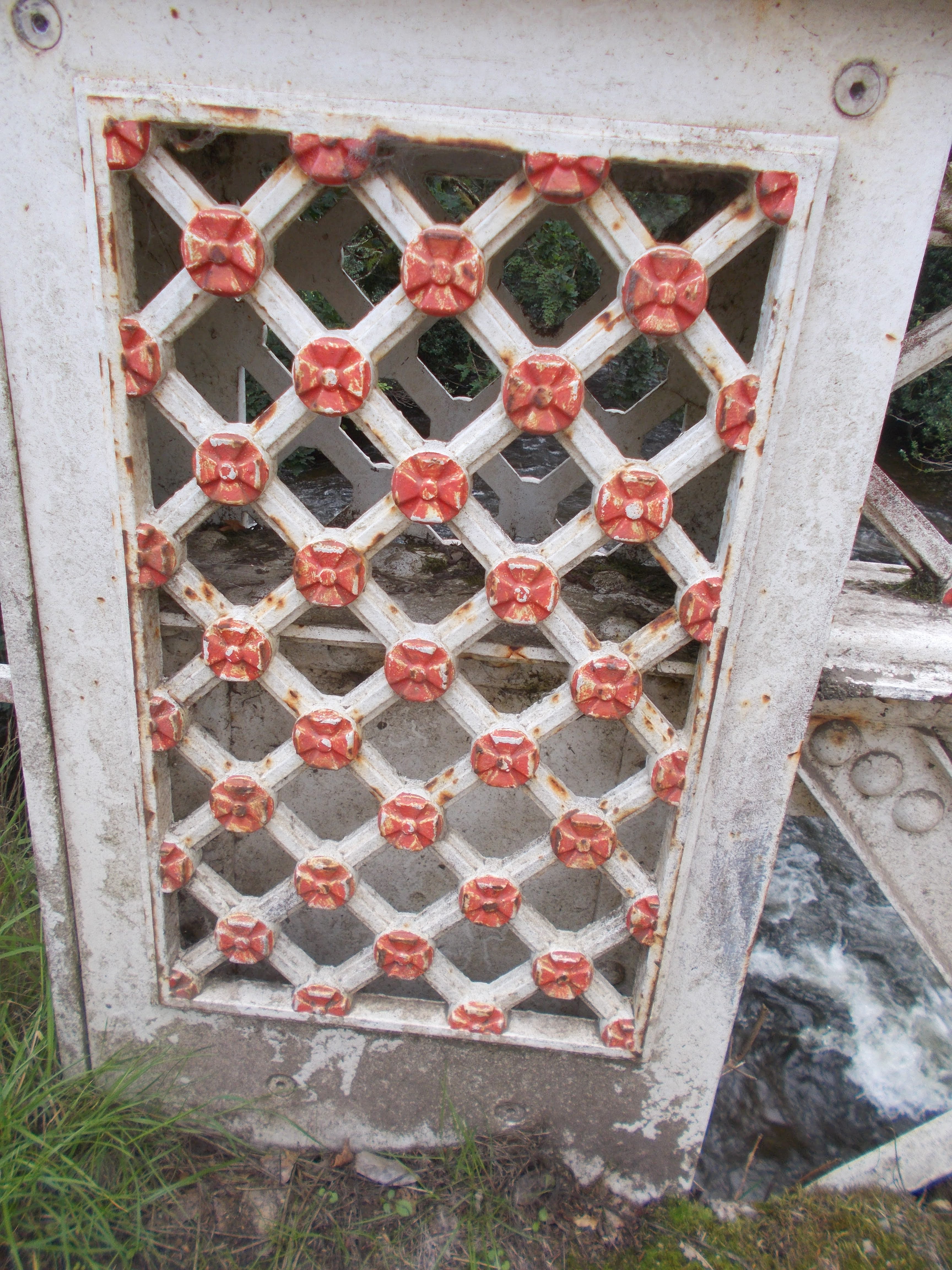
Decoration on Marsh Bridge

"The hedge that moved"
I was told by someone who was living at Higher Marsh in August 1952, that a section of bank and three beech trees close to the River Barle upstream of Marsh Bridge was moved wholesale by the force of the water about 50 metres downstream.  It remains in the middle of a field and the trees have carried on growing.  There is no public access to the field, so this was the best photo I could get of the trees.  They are located slightly to the left of the centre of the photo.

Thursday, 1 February 2024

Stoney Littleton Long Barrow

Stoney Littleton Long Barrow was built in the early Neolithic period, probably c3800-3400 BC.   It contained the remains of over a dozen men, women and children, possibly 3 or 4 generations of the same family.  It may also have been a religious shrine and/or way of marking territory.

Most of the stone and earth used to build the long barrow were quarried from near the site but the large slabs, which form the chambers, came from outcrops over 5 miles away.  The barrow was used for about 200 years before the forecourt was filled with stone and the entrance was blocked up. There is a large fossil ammonite on the western portal stone at the entrance.

The site was rediscovered by a farmer in 1760 and the site was excavated in 1816. It was partly restored in 1858 and again more recently.  Visitors to the site can explore the tomb by crawling along the 13m narrow passage.

Stoney Littleton Long Barrow

Entrance to the long barrow

Inside the long barrow

Fossil ammonite at the entrance

Diagram showing the internal layout of the long barrow